We’ve been saying for some time that we’ve been taking many local hikes in Sarajevo, Bosnia & Herzegovina. And since we’ve been holed up in our Airbnb for the last few days avoiding the rain, now is the time to talk about them!
The city is surrounded by forested mountains with wildlife preserves and national parks, along with trails that punch above their weight class in terms of visual impact.
We’ve had a great time exploring them.
But man, it was tough to find good hiking information! We searched the internet for leads on possible trails, found topo maps that confirmed routes, and then figured out how to access the trailheads without a car.
So what we present is a manual of sorts – how to make 5 fantastic nature hikes in Sarajevo.
Hopefully, prospective Sarajevo hikers will appreciate our effort in putting this guide together! And for those of you who are non-hikers, we hope you enjoy the pretty photos. 🙂
A Quick Recommendation
Before we begin, we strongly recommend downloading our trail maps before hiking. It can be easy to get lost on some of these trails without the maps!
You can download trail map data by clicking the links at the top of each of our AllTrails maps. You’ll need to create a free AllTrails account if you don’t already have one. Be aware that you need to do this on PC, unless you have a premium AllTrails account.
Once you have selected the trail map you want, click “More“.
Then click “Download Route” to download the trail map data in the file format of your choice.
Then upload the file to the offline-capable smartphone map app you prefer. We like Organic Maps and Maps.me.
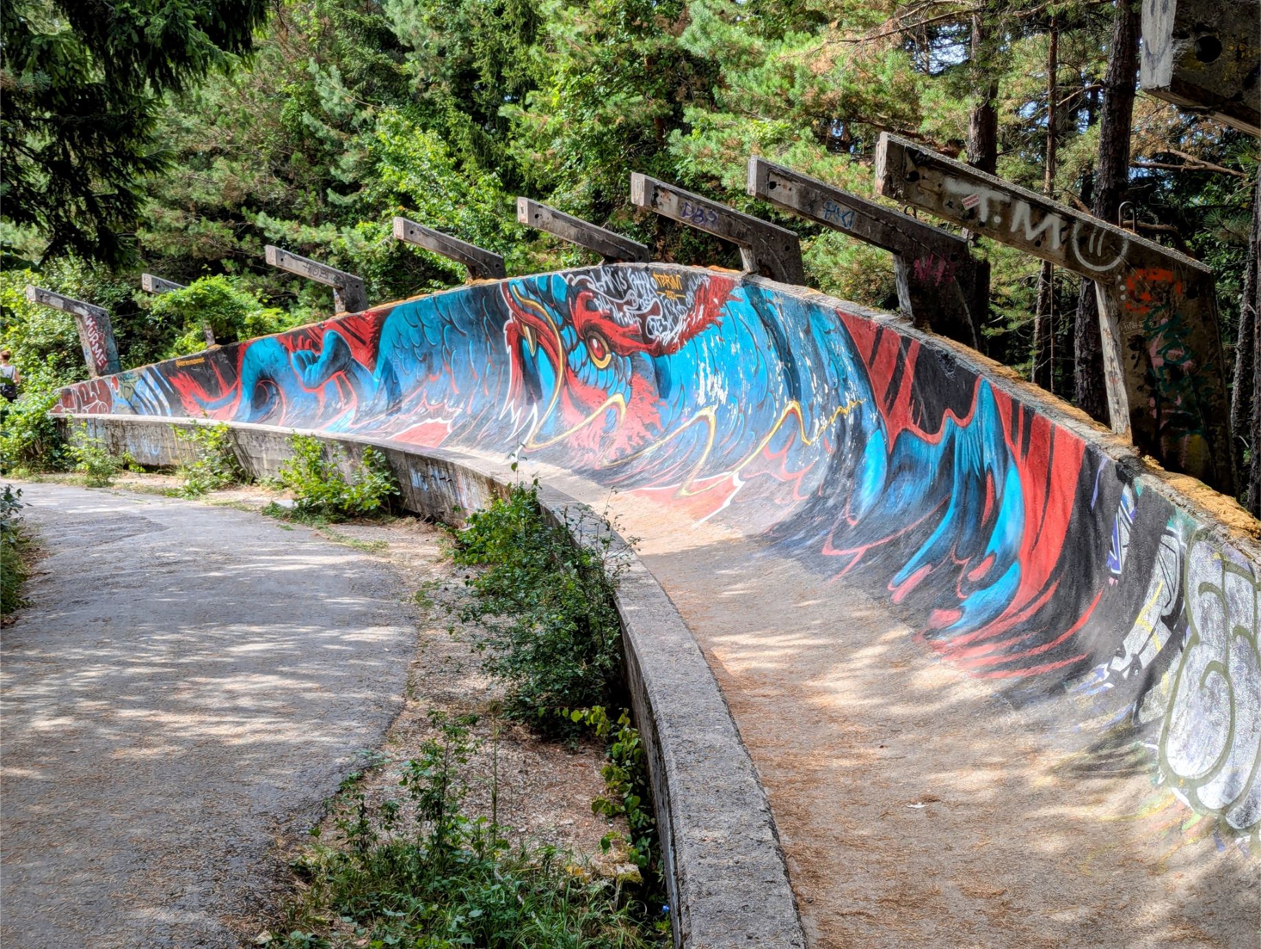
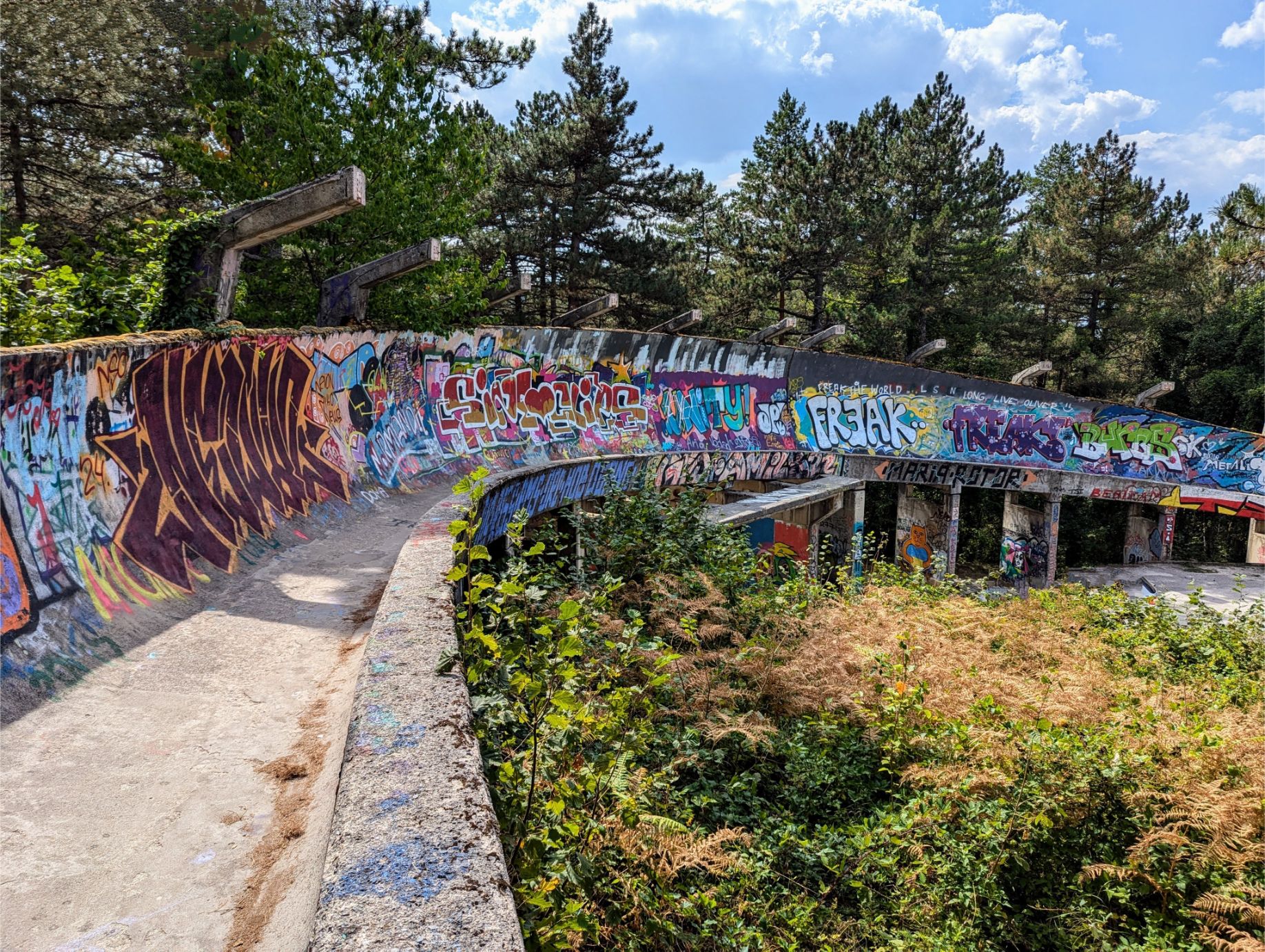
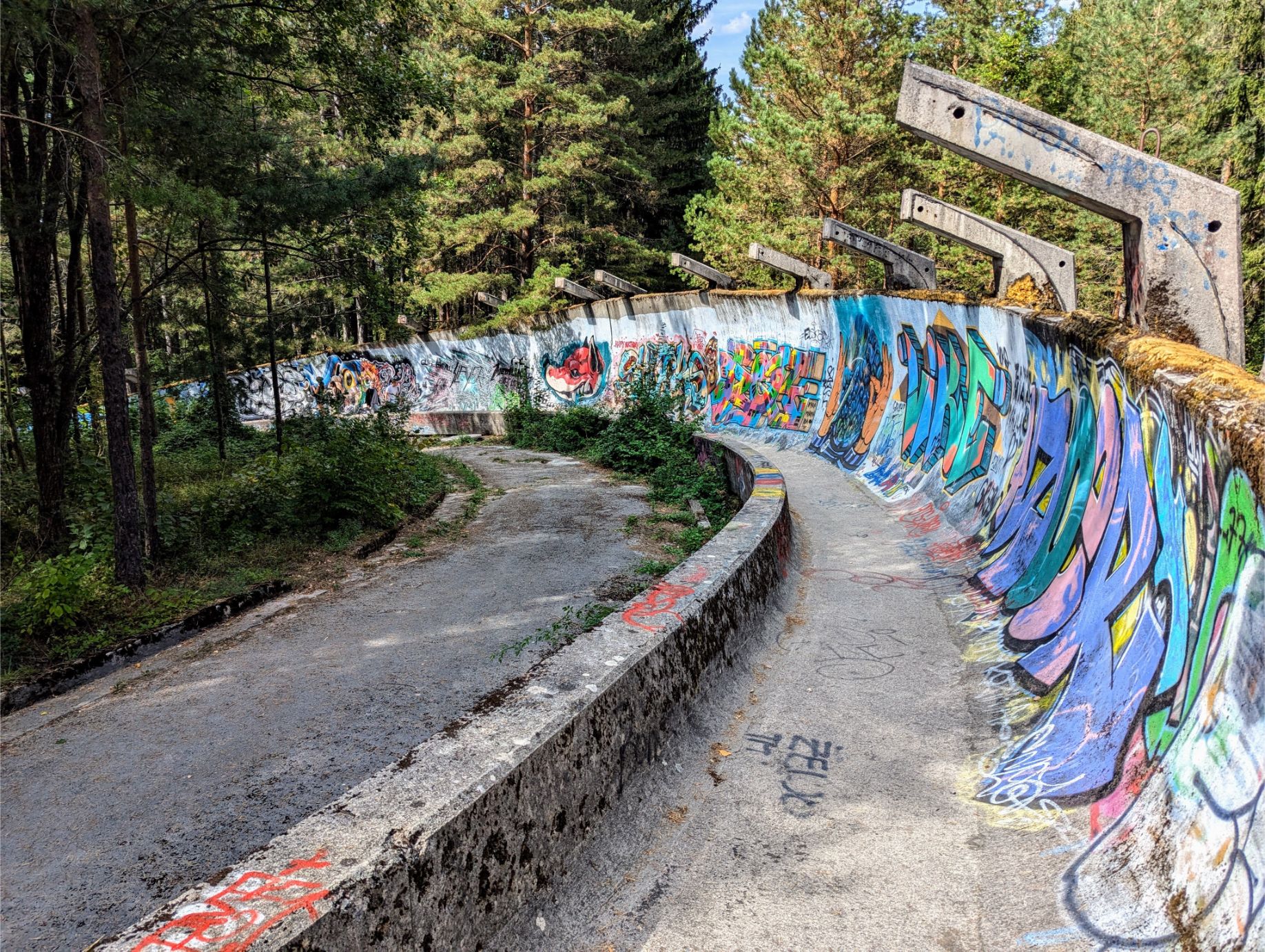
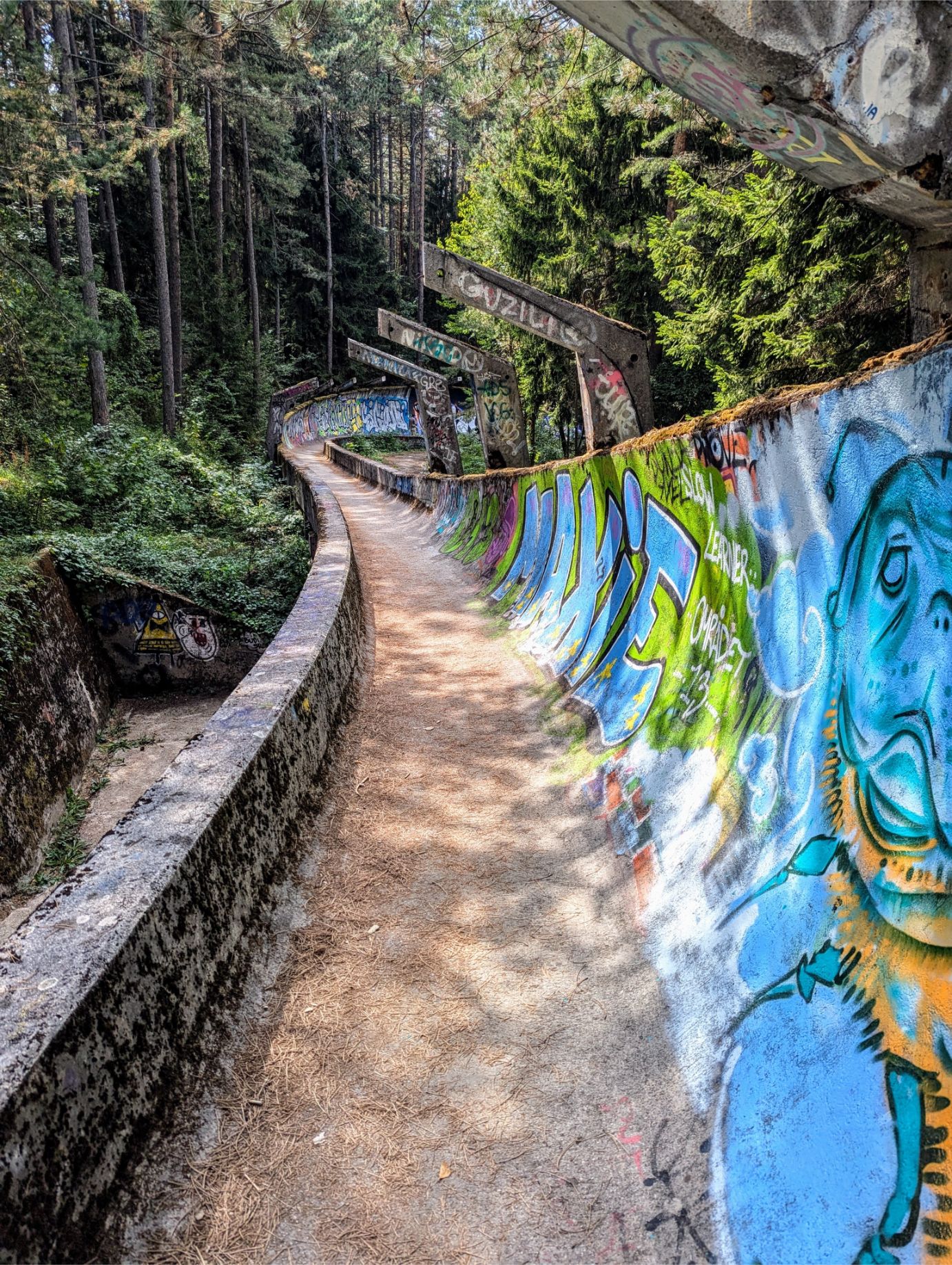
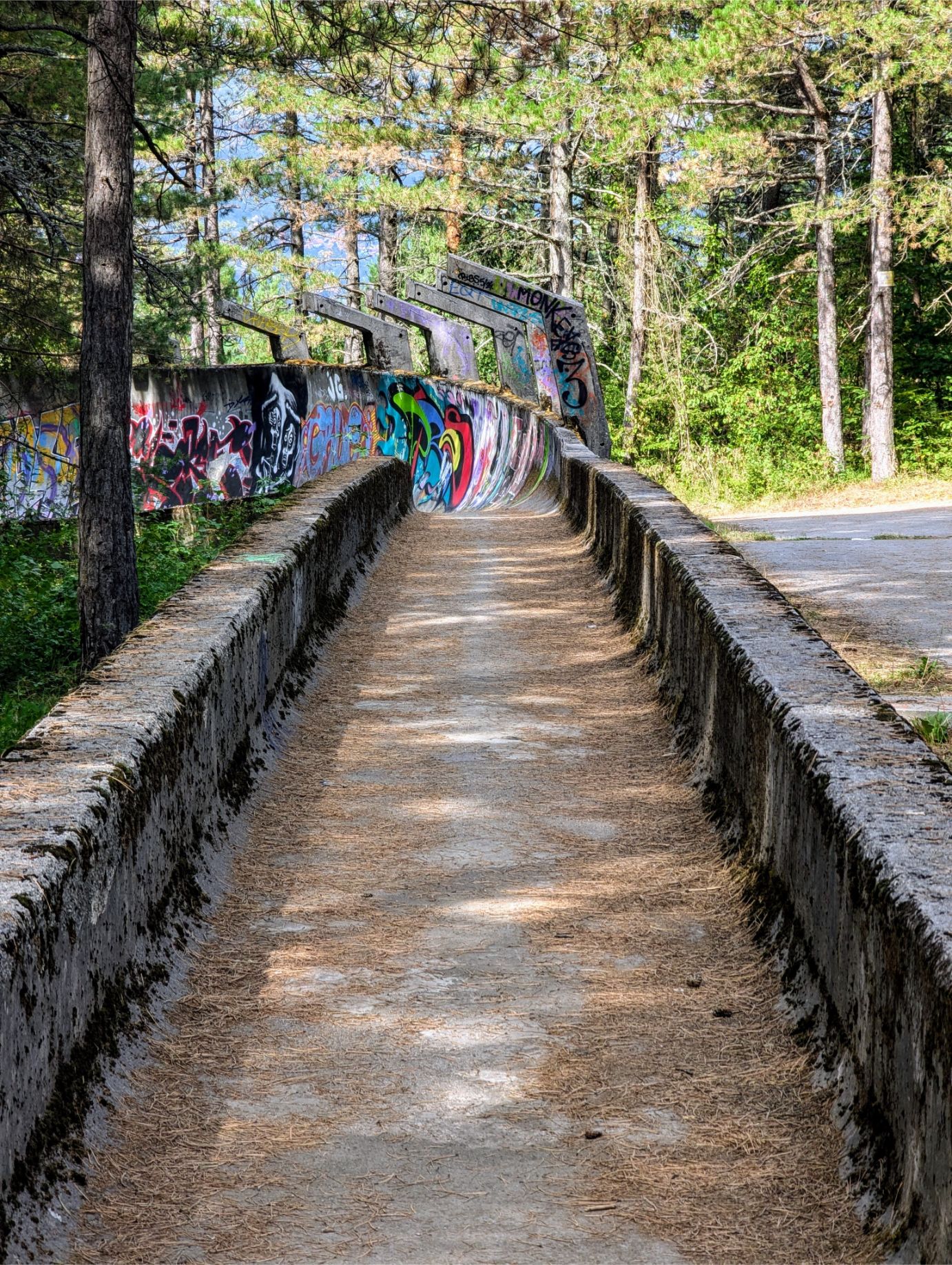
Trebević Olympic Bobsled Trail
At 0.82 miles long (one-way) and 10 feet of elevation gain, the Trebević Olympic Bobsled Trail is an easy hike. As the trail name implies, the “trail” is walking down the old 1984 Olympic Bobsled track, which has since been abandoned. Graffiti artists have been encouraged to display their works on the track, making for one of the most surreal hikes we have ever done.
Beautiful, and highly recommended!
GETTING TO THE TRAILHEAD:
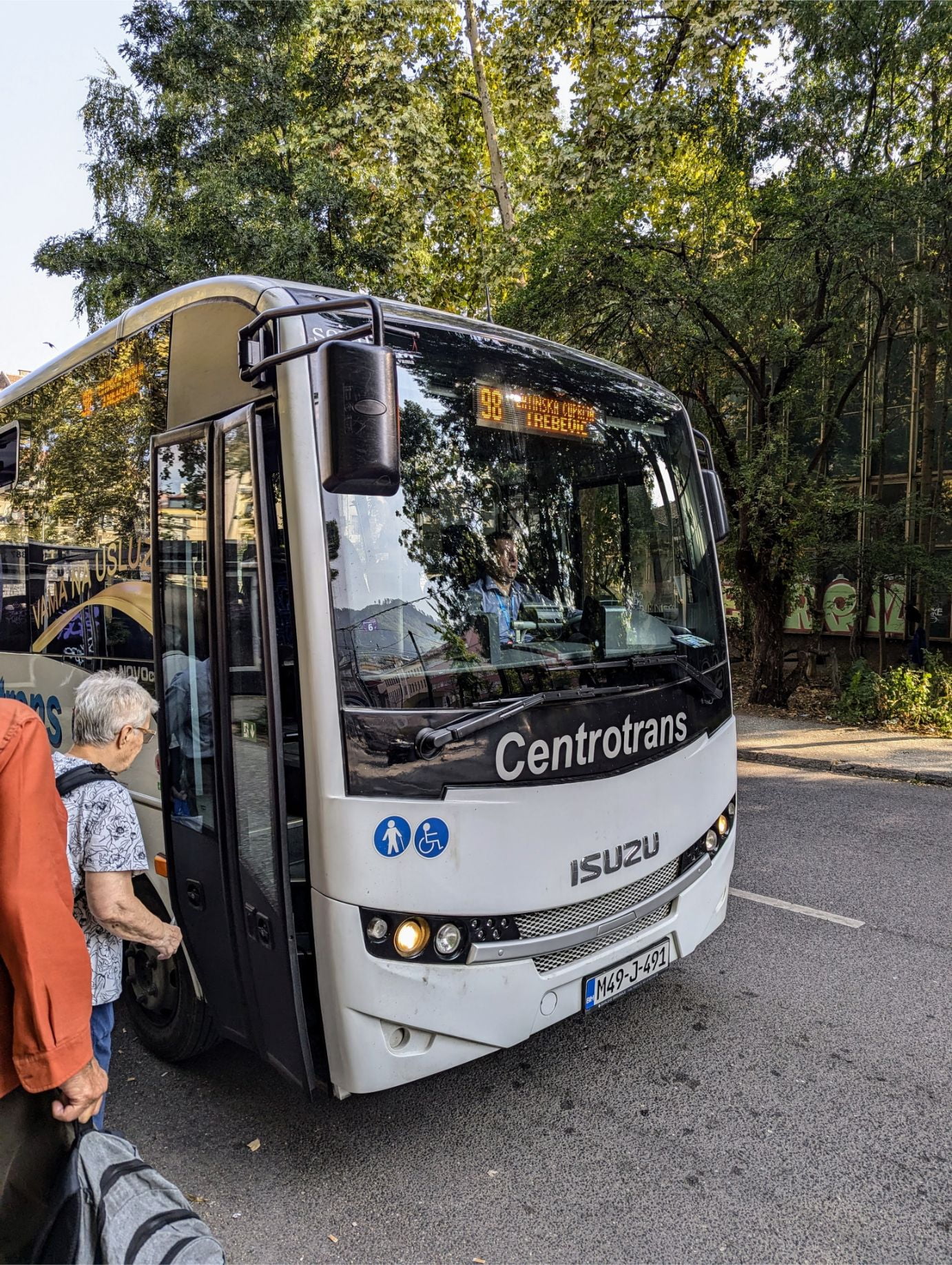
OPTION 1 – Take the Centrotrans Minibus 98 (Latinska – Cuprija Trebevic route)
This is what we did. There is only ONE 9 am Saturday/Sunday departure from the Latinska Cuprija Terminal, found next to the Latin Bridge. The bus DOES NOT run on weekdays. Don’t be surprised if the bus is a little late to the pickup point. Cost: 1.80 BAM ($1.03 USD) cash paid to the driver.
All aboard!
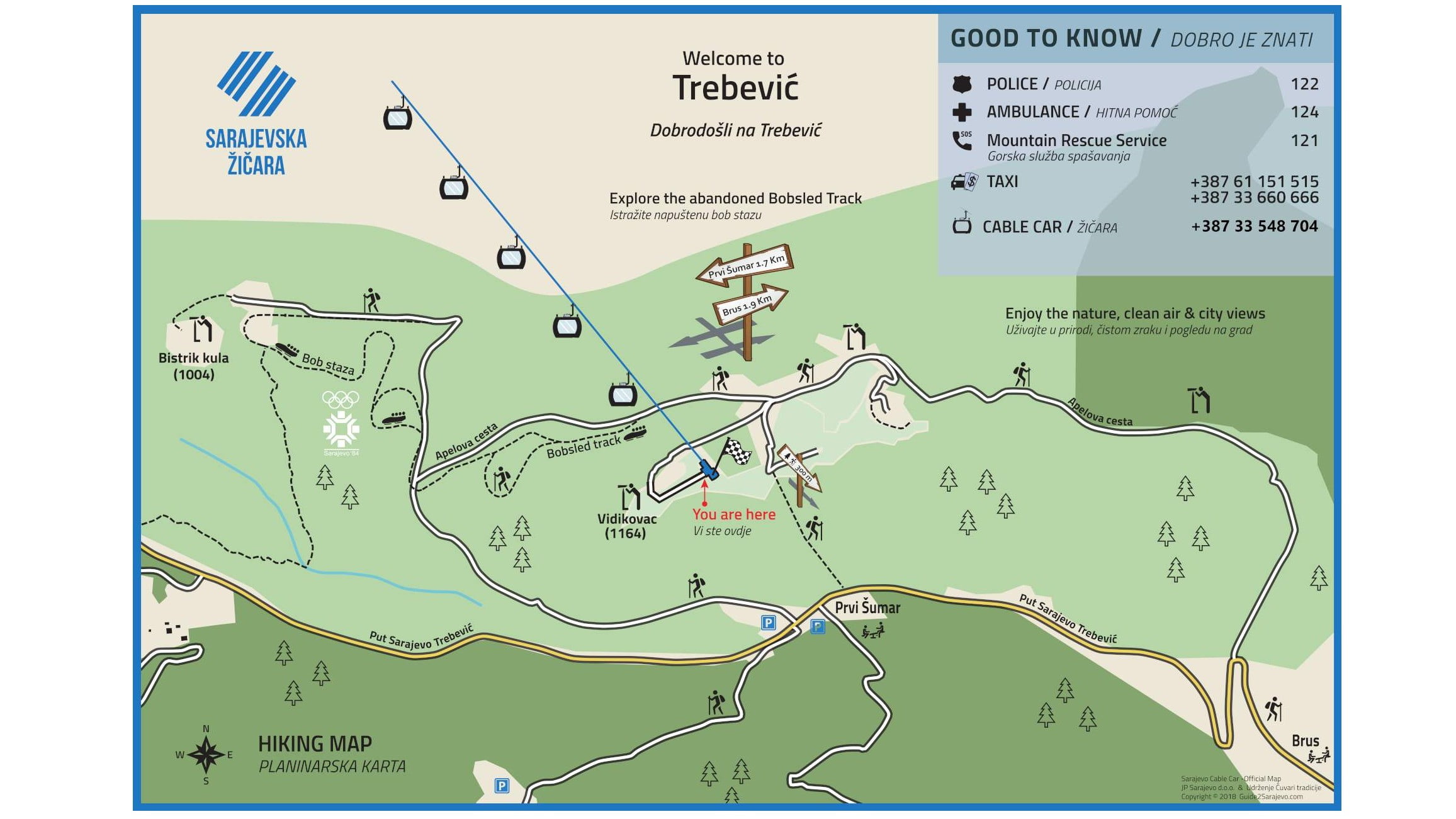
Be sure to verify all departure times with the Centrocard app just in case. The bus will drop you off in front of the Pino Nature Hotel/Restaurant, which is just a short walk to the beginning of the bobsled track.
See the link for operating hours and location. At 30 BAM ($17.11 USD) for a round-trip ticket or 20 BAM ($11.41 USD) for a one-way ticket, this is hands down the most pricey option. And when the cable car drops you off, you are very close to the beginning of the bobsled track.
The cable car drops you off at “You are here”. And the minibus drops you off at “Prvi Sumar”.
RETURNING TO SARAJEVO:
OPTION 1 – Walk down the mountain back to Sarajevo.
This is what we did. We just used our maps.me trail app to guide us. The path back to Sarajevo begins at the bottom of the bobsled track.
OPTION 2 – Take the Centrotrans Minibus 98 (Cuprija Trebevic – Latinska route).
You’ll have to walk back up the bobsled track (or take the road) to take the minibus to Sarajevo. There is only ONE 4 pm Saturday/Sunday return to Latinska Cuprija Terminal from where you were originally dropped off.
You’ll have to walk back up the bobsled track (or take the road) to take the cable car back to Sarajevo.
NOTES:
No special gear is needed for this hike.
OUR HIKE PHOTOS:
Starting downward. The banks are where the best graffiti is.
This was one of the most interesting hikes we have ever taken. There is nothing else like it in the world!
Trebević Peak Circuit Trail
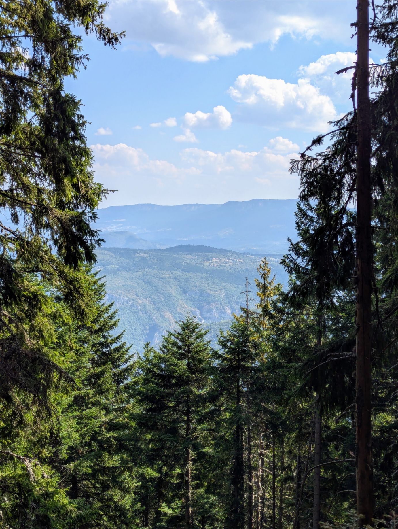
At 6.48 miles and 2,031 feet of elevation gain, you should be reasonably fit for the Trebević Peak Circuit Trail. But it is totally worth it! The trail is very interesting and will take you through forests, recreational parks, refreshment stands, and old military fortifications.
Do what we did – pack a lunch and eat in on the peak of Mt. Trebević! You’ll need a break and will want to take time to soak in the fabulous views. 🙂
What was a big surprise to us was that there is a serious hiking culture in Sarajevo. Many families were seen walking the trail, with children in tow. And older folks were walking the trail too, independent of any help.
Hopefully we’ll be that fit when we are in our 70s and 80s.
If you are a glutton for punishment, do the Trebević Peak Circuit Trail first, then the Trebević Olympic Bobsled Trail, and then walk back to Sarajevo.
That is what we did! 🙂
NOTES:
Wear good hiking shoes and bring sun protection. Also, bring water and snacks! Last, make sure you walk CLOCKWISE on our trail route!
OUR HIKE PHOTOS:
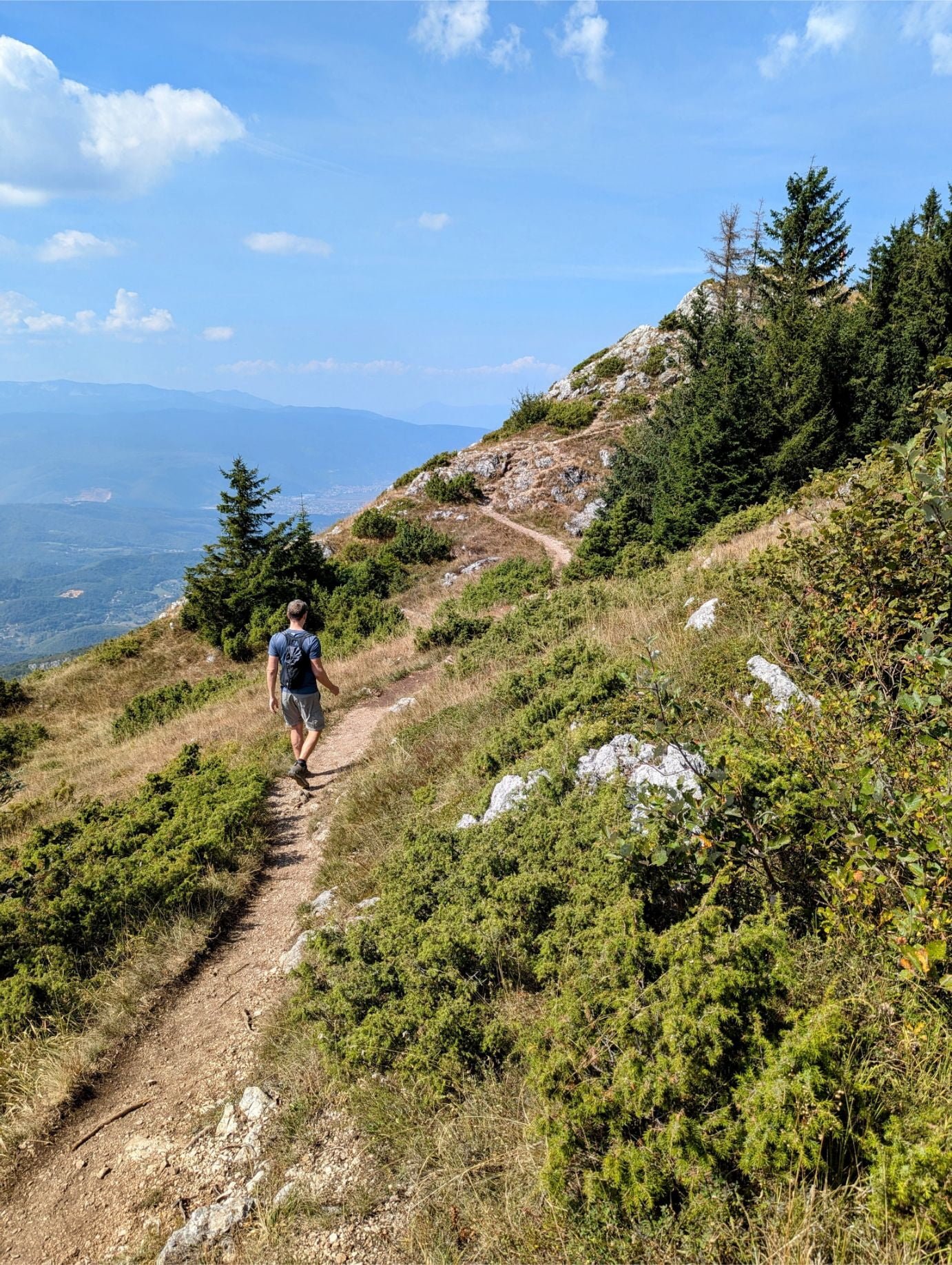
Taking the long uphill trail to the summit. At least it is shaded!
Pretty views through the trees.
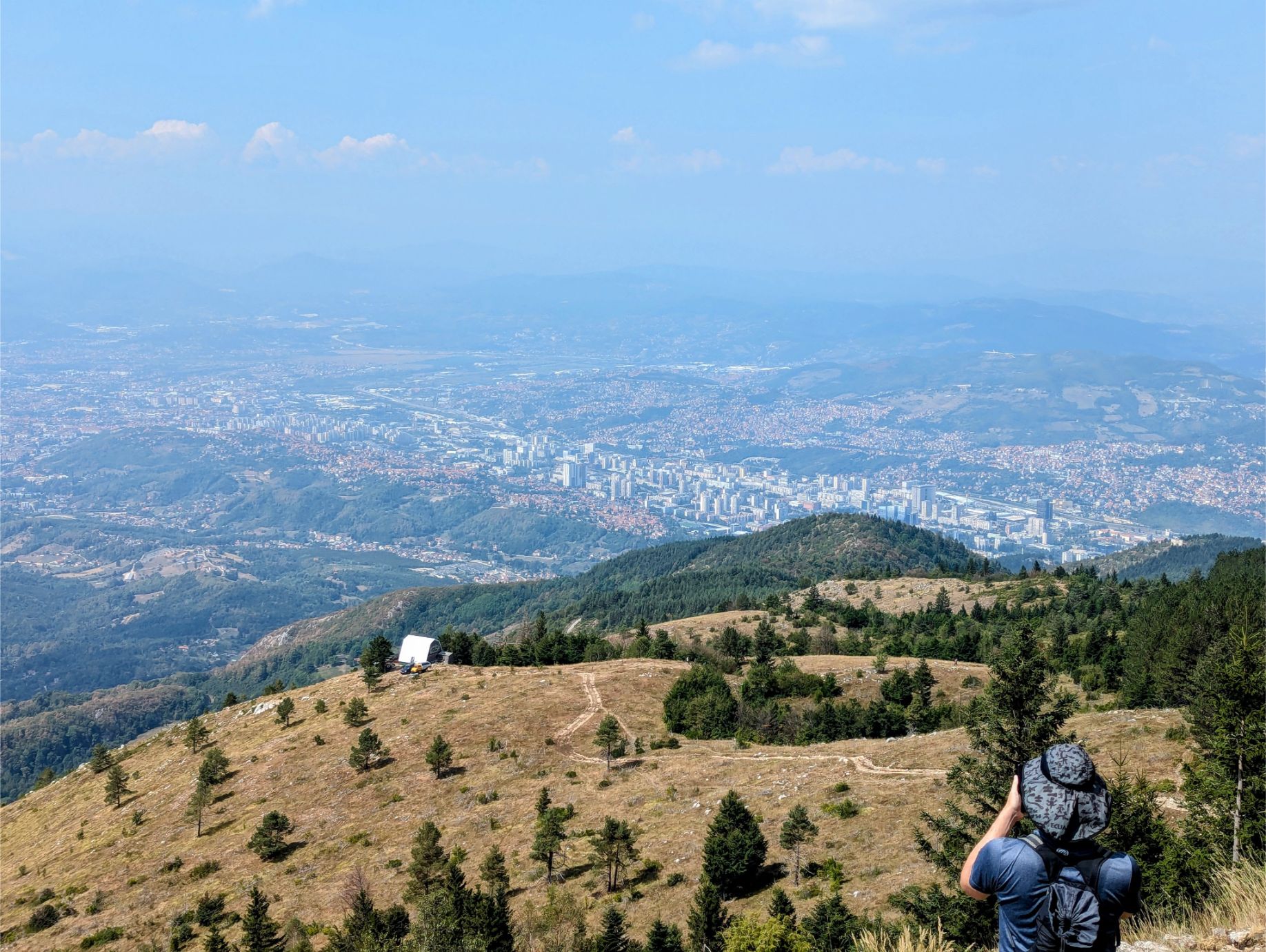
Fantastic views from the summit.
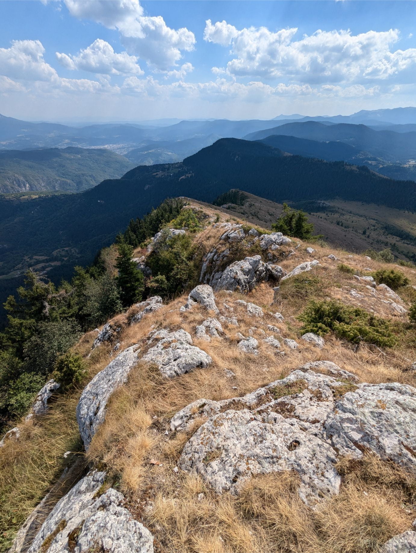
Walking to the ridgeline.
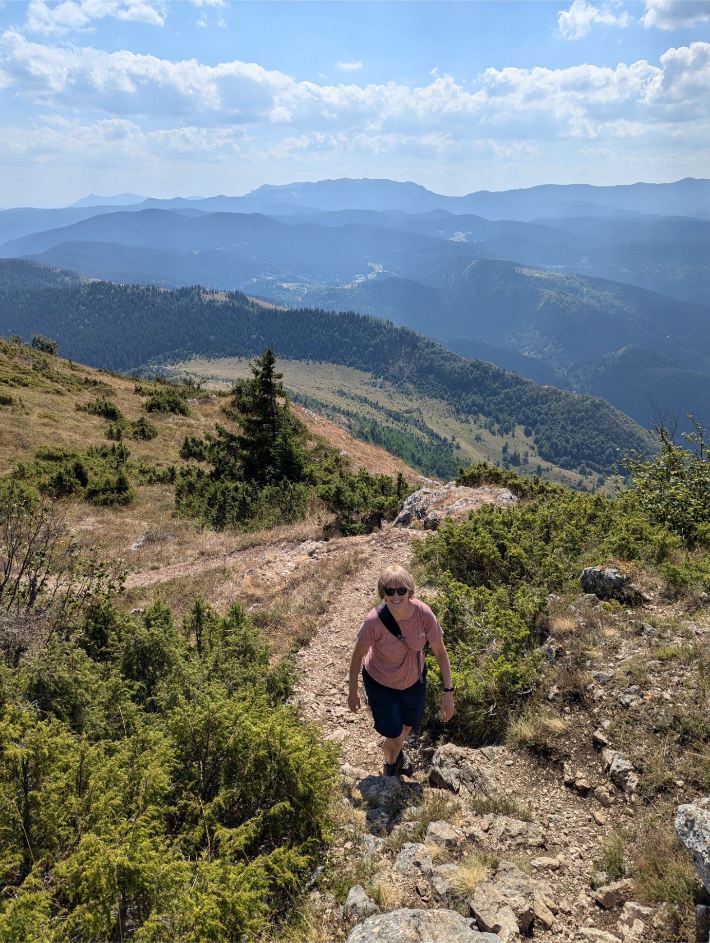
Rhonda followed close behind.
The ridgeline goes on and on. Great views in every direction!
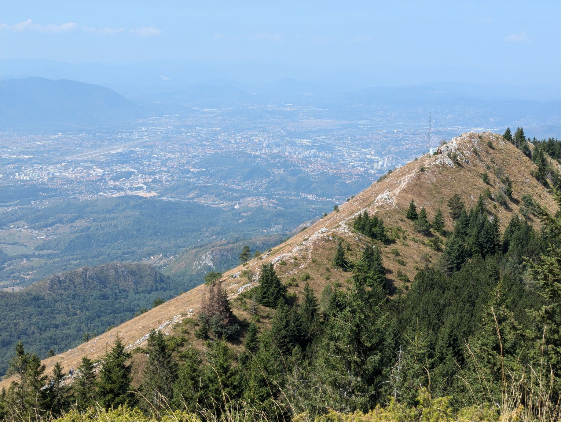
Starting the descent. You can see Sarajevo in the distance as well as a refreshment hut for hikers closer to us.
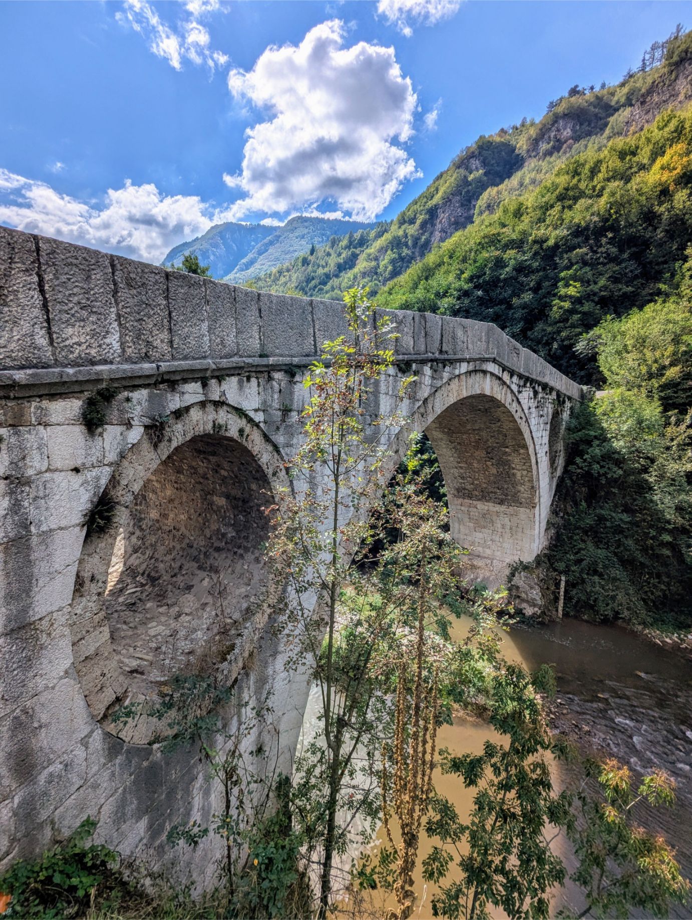
Sarajevo City Hall To Goat Bridge Trail
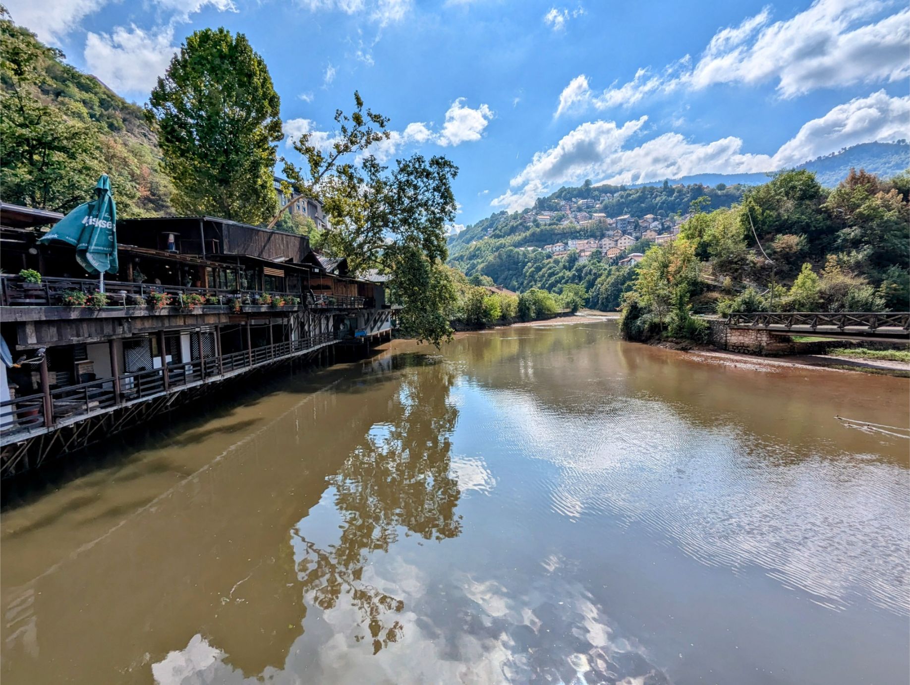
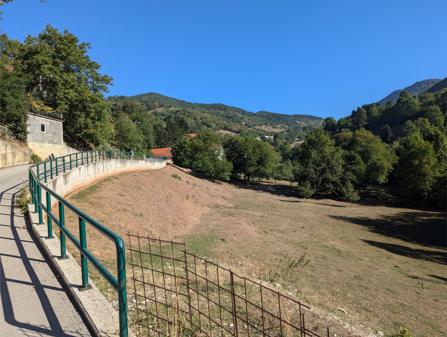
At 3.78 miles long (up and back) and 663 feet total elevation gain, this trail is very easy. It starts from Sarajevo City Hall and follows the river eastward, first along low-traffic streets and then along a dedicated paved walking/biking path. Eventually, you end up at the Goat Bridge, the oldest Ottoman-style bridge in Sarajevo.
This is a very pleasant walk! The wooded path is interspersed with river views and scenery of the surrounding cliffs and mountains. Along the path, there are informational signs, parks, benches, and other local historical monuments relevant to the area.
Well worth the minimal effort needed to make this hike.
GETTING TO THE TRAILHEAD:
Since this trail starts/ends in the historic district of Sarajevo and is near several public transportation stops, it is easy to access on foot, or by tram/bus.
NOTES:
No special gear is needed for this hike.
OUR HIKE PHOTOS:
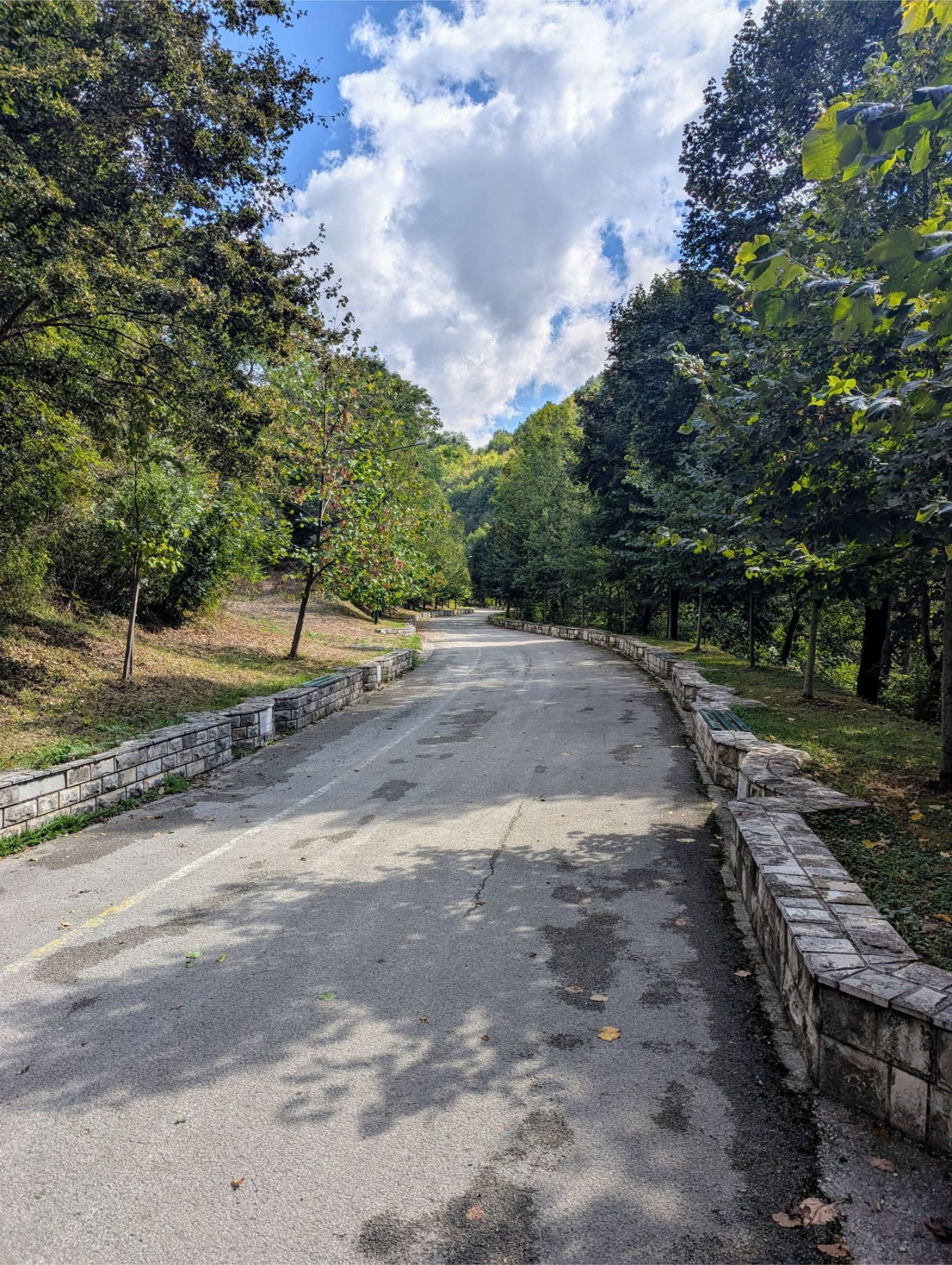
Near the beginning of the route, just before entering the formal walking/biking trail area.
The vast majority of the trail is a tree-lined walk/bike path with bench areas for seating. We suspect this used to be a railway, but information is lacking.
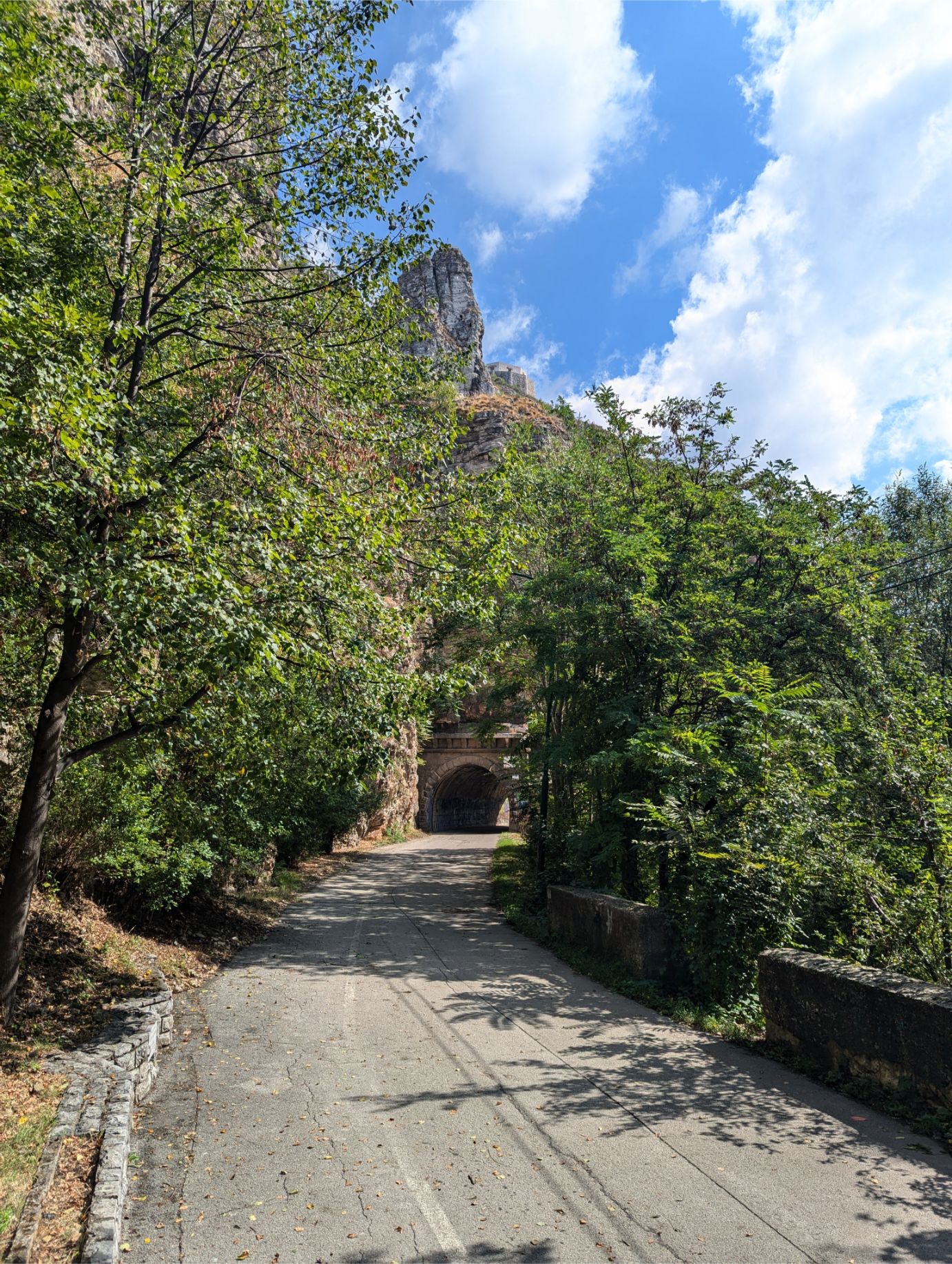
The short tunnels add a little spice to the trail.
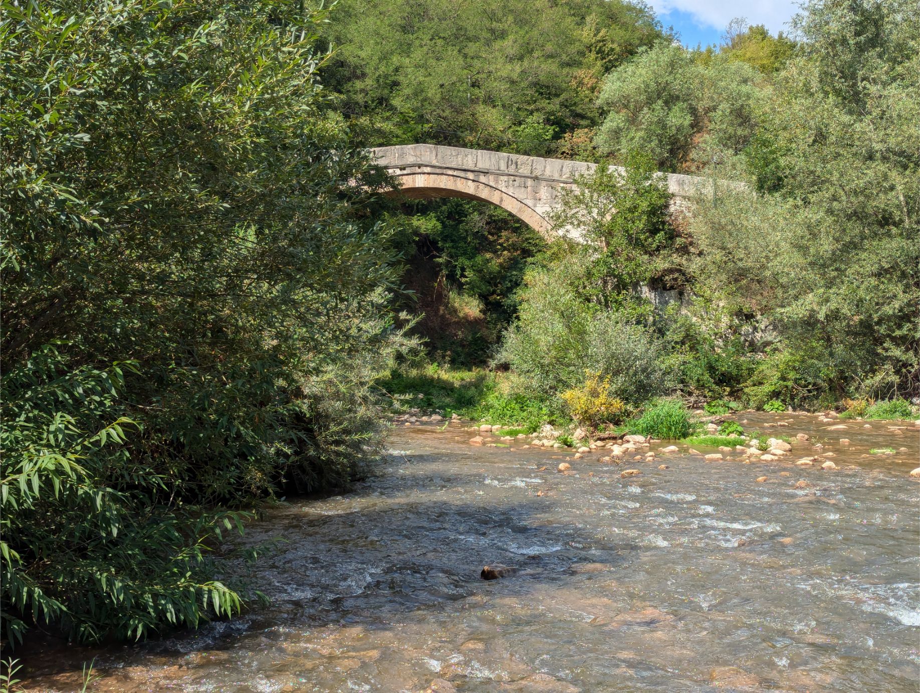
Starting the approach to the Goat Bridge.
The Goat Bridge is the only Ottoman-era bridge left in Sarajevo.
Too bad the trees got in the way of a nice Goat Bridge photo!
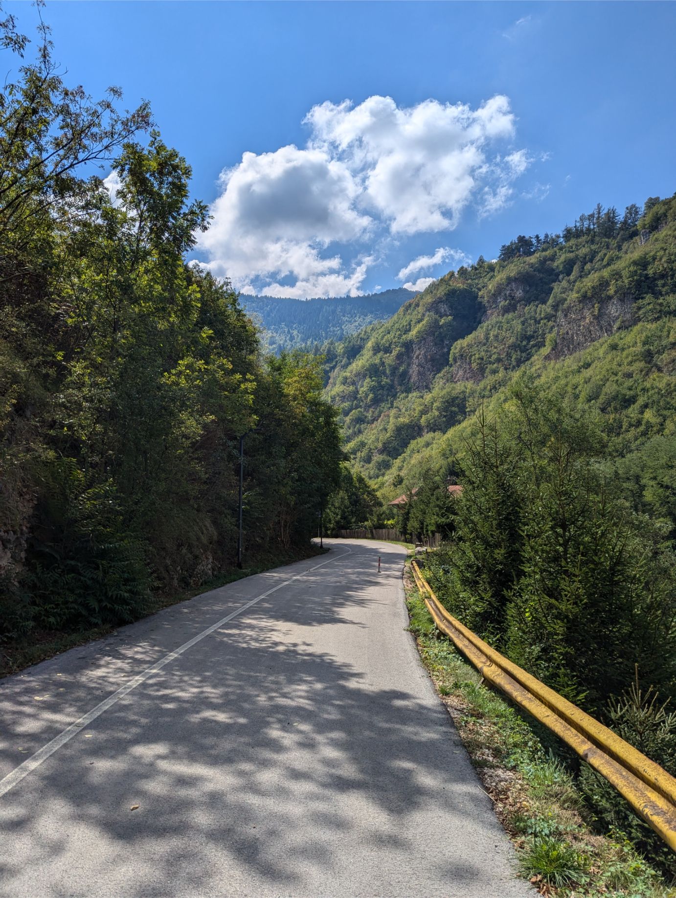
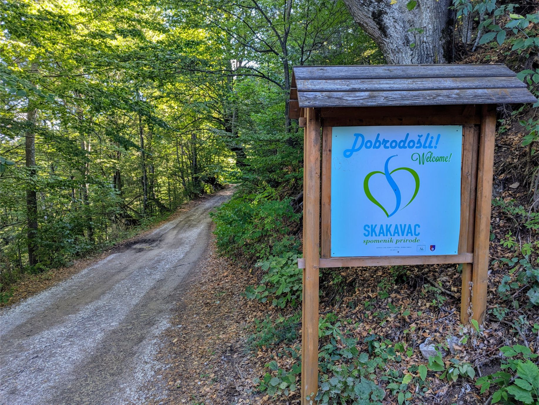
Nahorevo to Skakavac Waterfall Trail
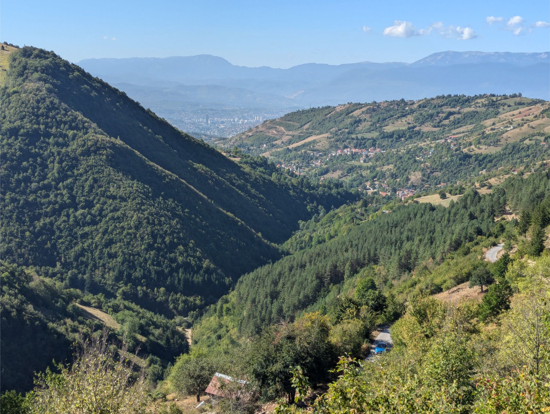
At 9.02 miles and 2,723 feet elevation gain, the Nahorevo to Skakavac Waterfall Trail is quite a workout, especially for the first third of the hike. But you’ll be rewarded with Bosnian village views, fantastic countryside scenery, well-shaded forest paths, and a waterfall (rainfall permitting)!
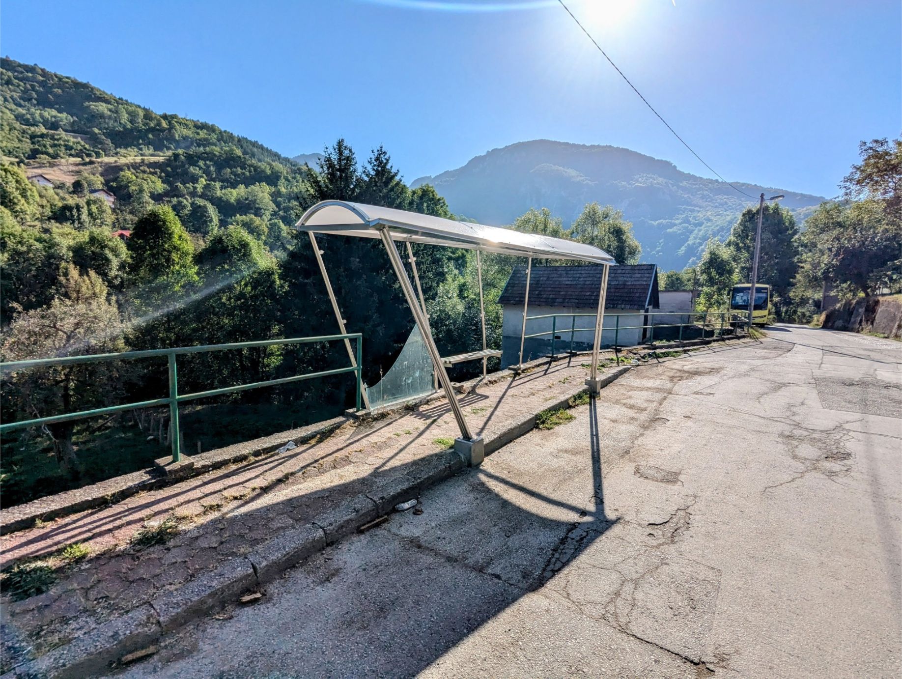
The trail begins at the Nahorevo Bus Stop. You’ll then walk uphill on quiet country roads until you reach Skakavak Nature Preserve. From there the elevation gain becomes MUCH more manageable.
As you can see from our trail map, there are other ways to form circuits that connect to the waterfall portion of the trail. We’ll likely try to do that if we ever have a chance to hike this trail again.
GETTING TO/FROM THE NAHOREVO BUS STOP:
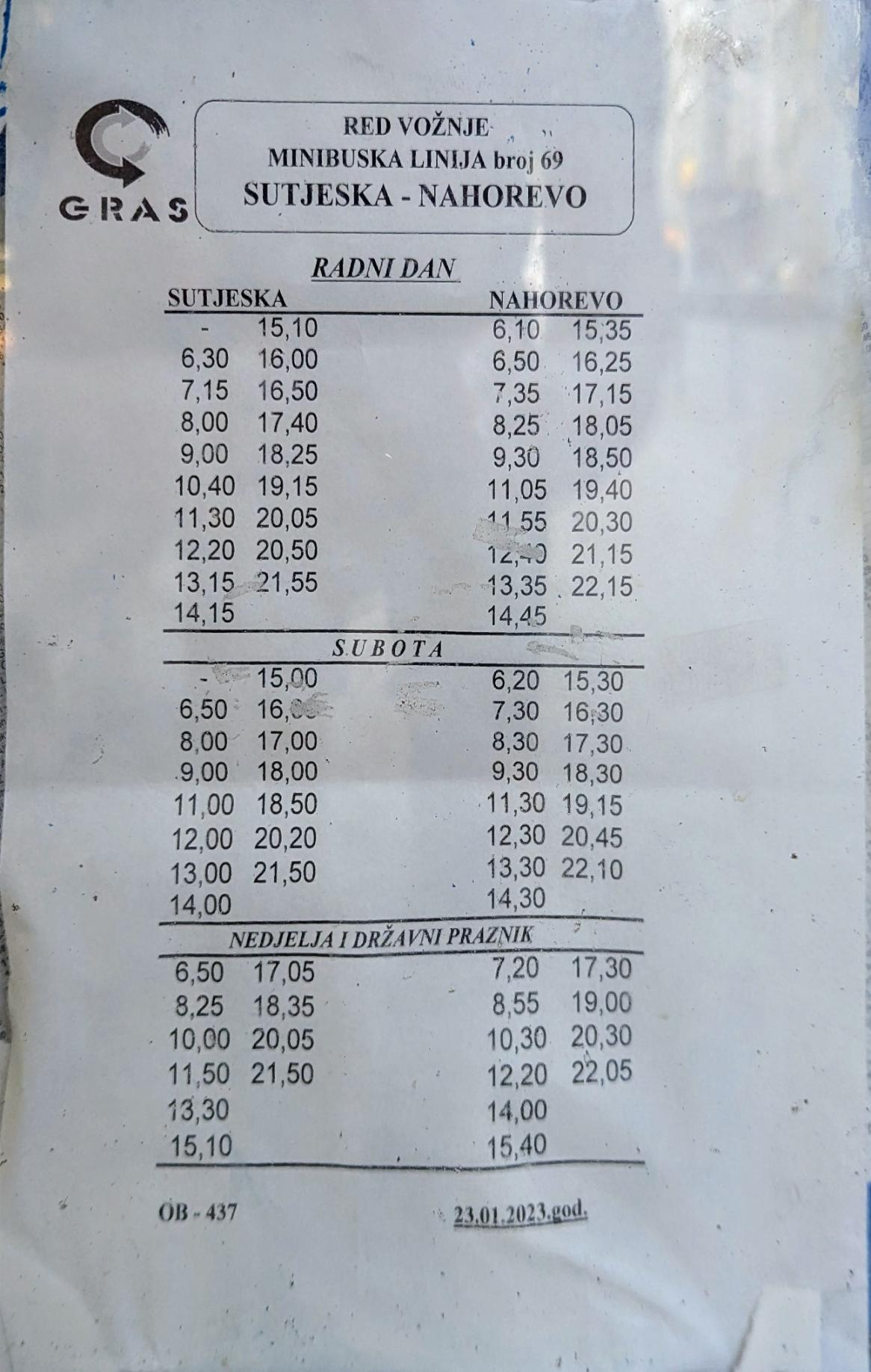
Gras Minibus 69 takes you to Nahorevo Bus Stop from the Sutjeska Bus Stop in central Sarajevo. The minibus runs 7 days per week at many times per day. Below is a photo of the bus schedule, which is accurate as of the writing of this post. Cost: 1.80 BAM ($1.03 USD) cash paid to the driver.
The minibus 69 schedule, taped up at the Sutjeska Bus Stop. Gras bus departure information distribution is as low-tech as you can get.
Getting on minibus 69.
The bus stop in Nahorevo. This is where the trail route starts.
NOTES:
This is a pretty popular trail. So if you want to see fewer people, do the hike on a weekday morning. Wear good hiking shoes and bring sun protection. Also, bring water and snacks! Last, make sure you walk COUNTERCLOCKWISE on our trail route.
OUR HIKE PHOTOS:
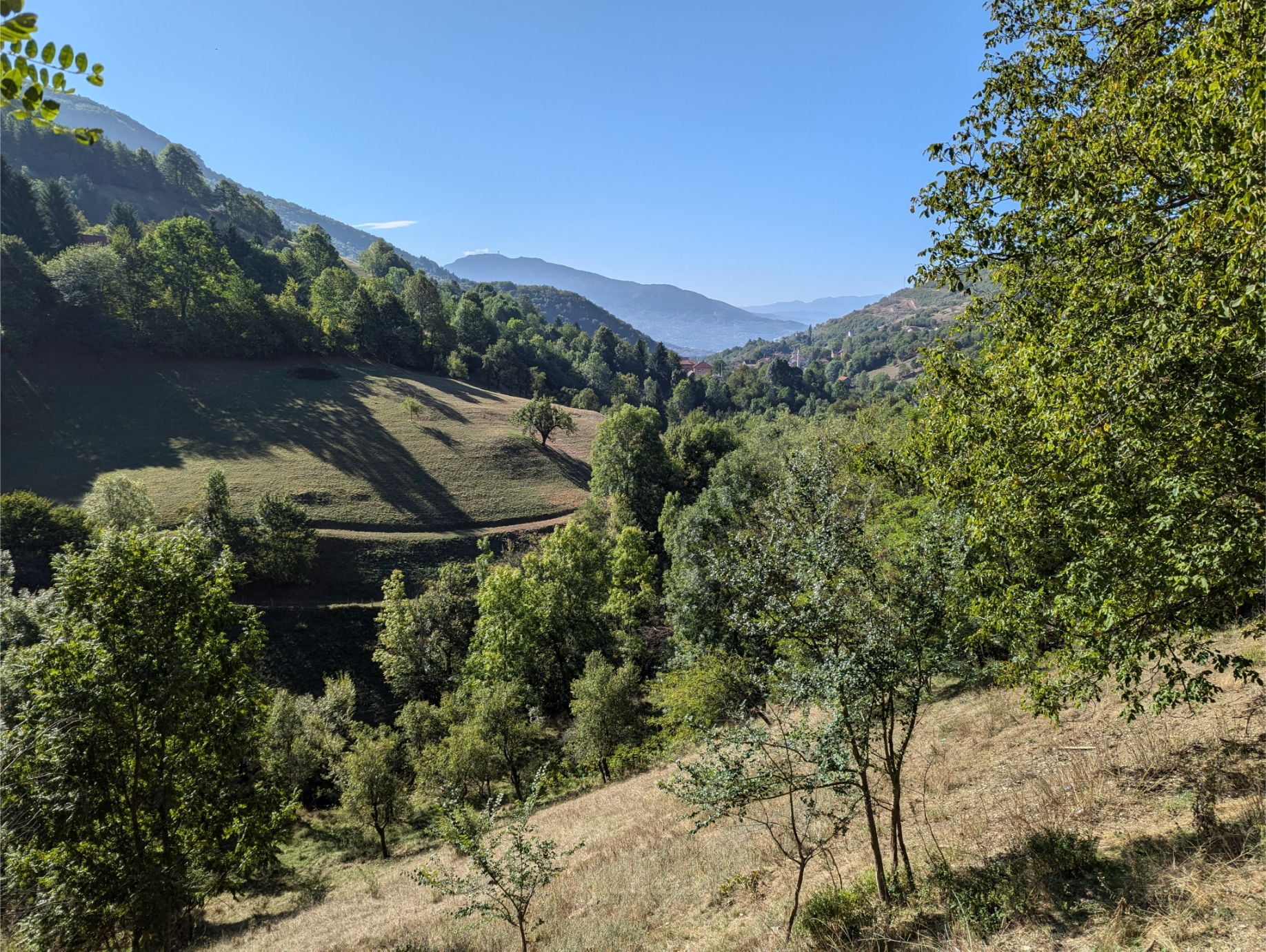
Heading upward towards the Skakavac Nature Preserve. This is where most of the elevation gain for the day happens.
The view halfway up the incline.
Near the top of the incline looking back from whence we came.
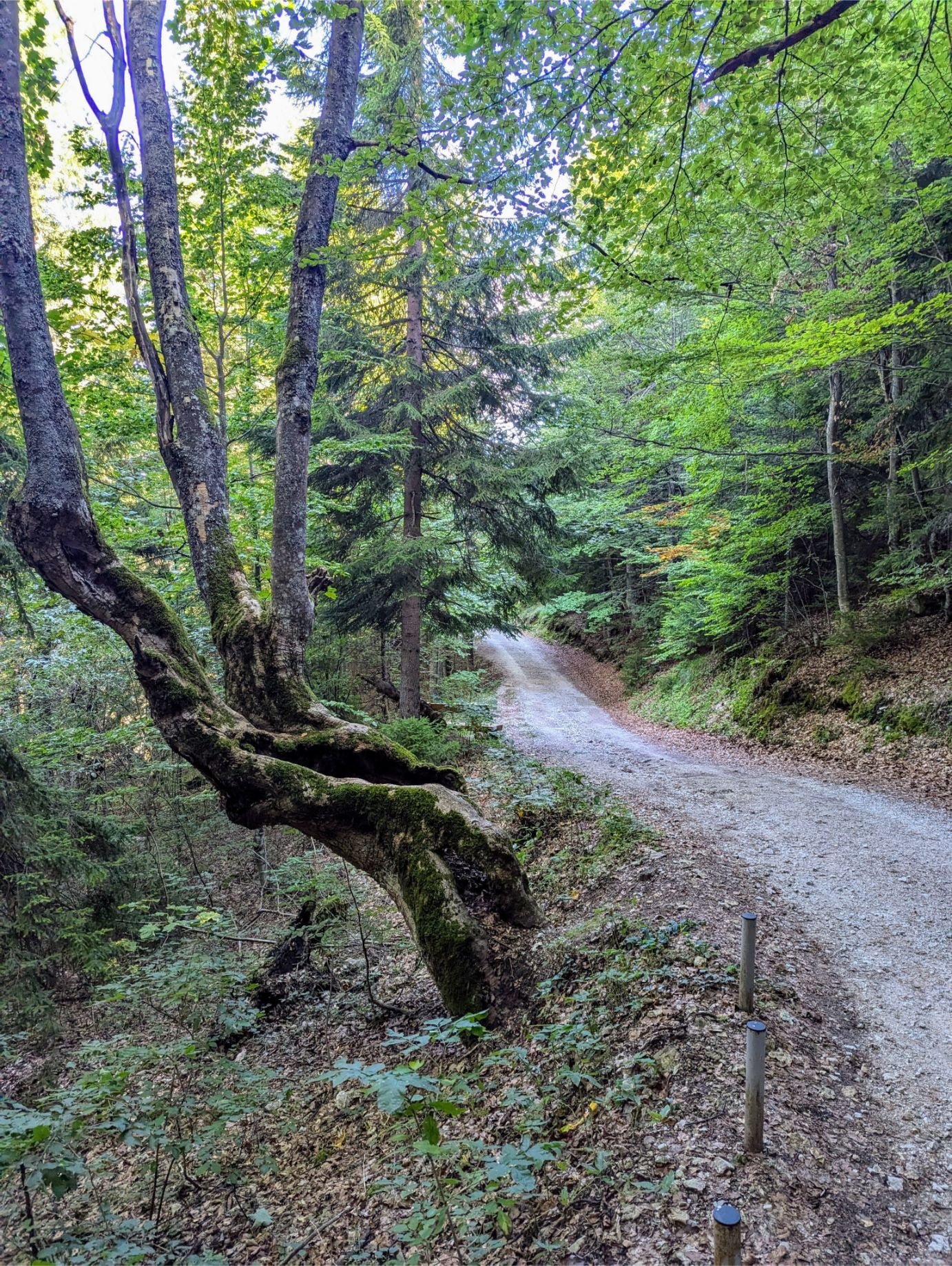
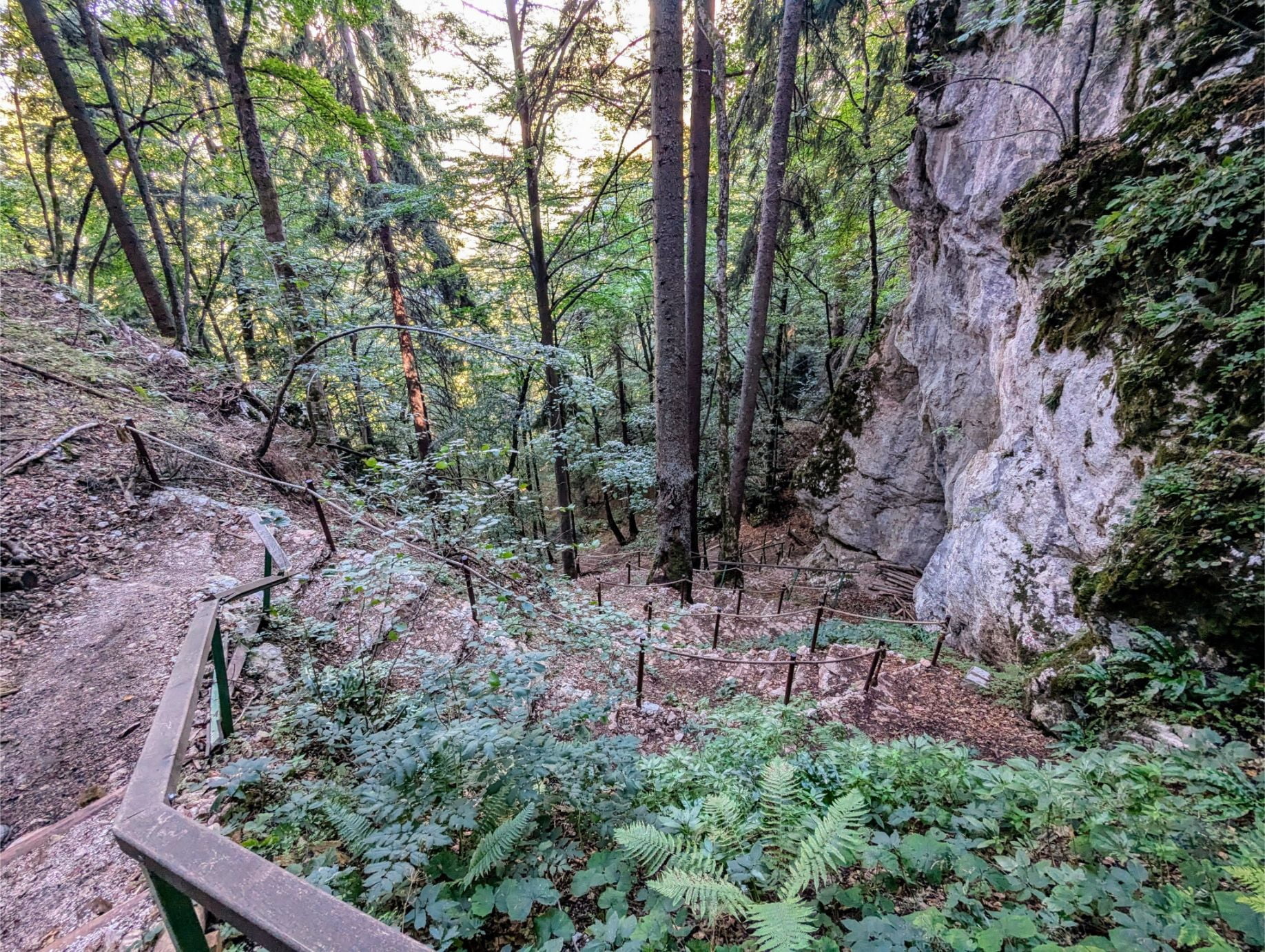
Much of the trail once you enter the nature preserve is through forest.
Continuing onward through the preserve.
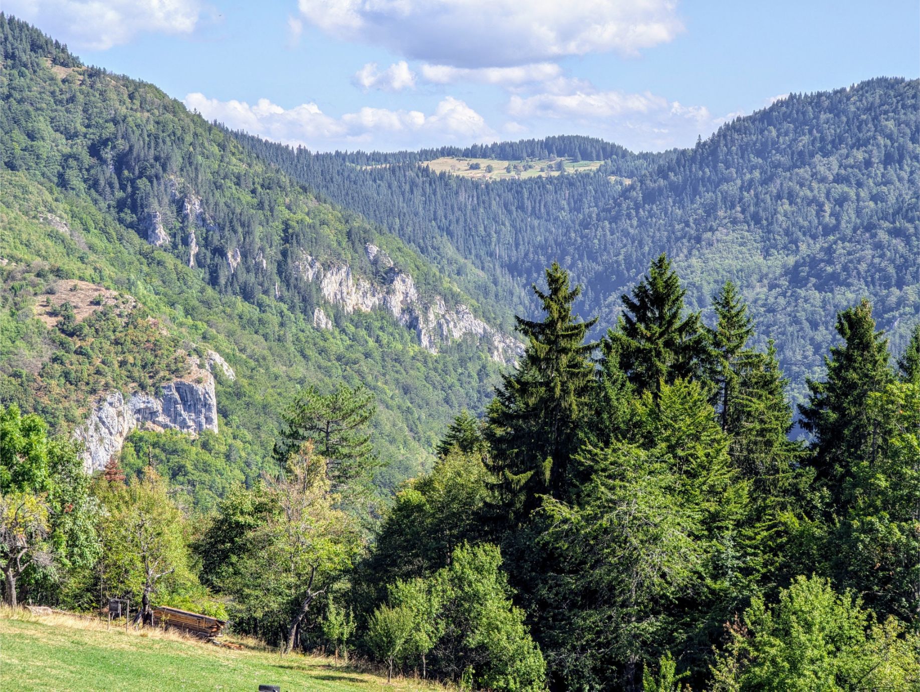
But the view opens up from time to time.
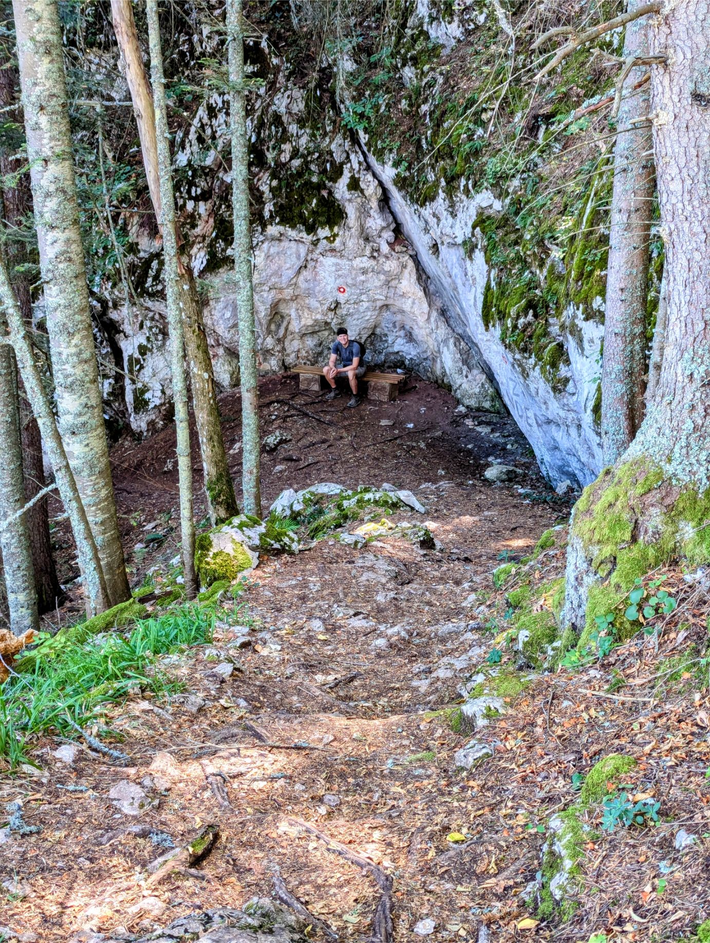
At the halfway point on the trail, the trail starts downward. Time for a water break!
We weren’t kidding about the descent!
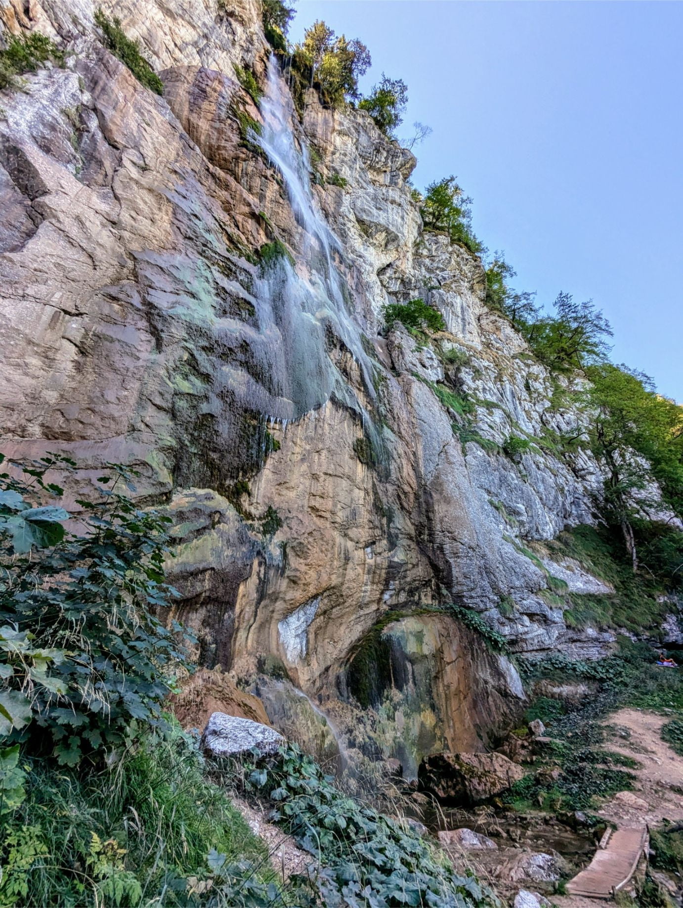
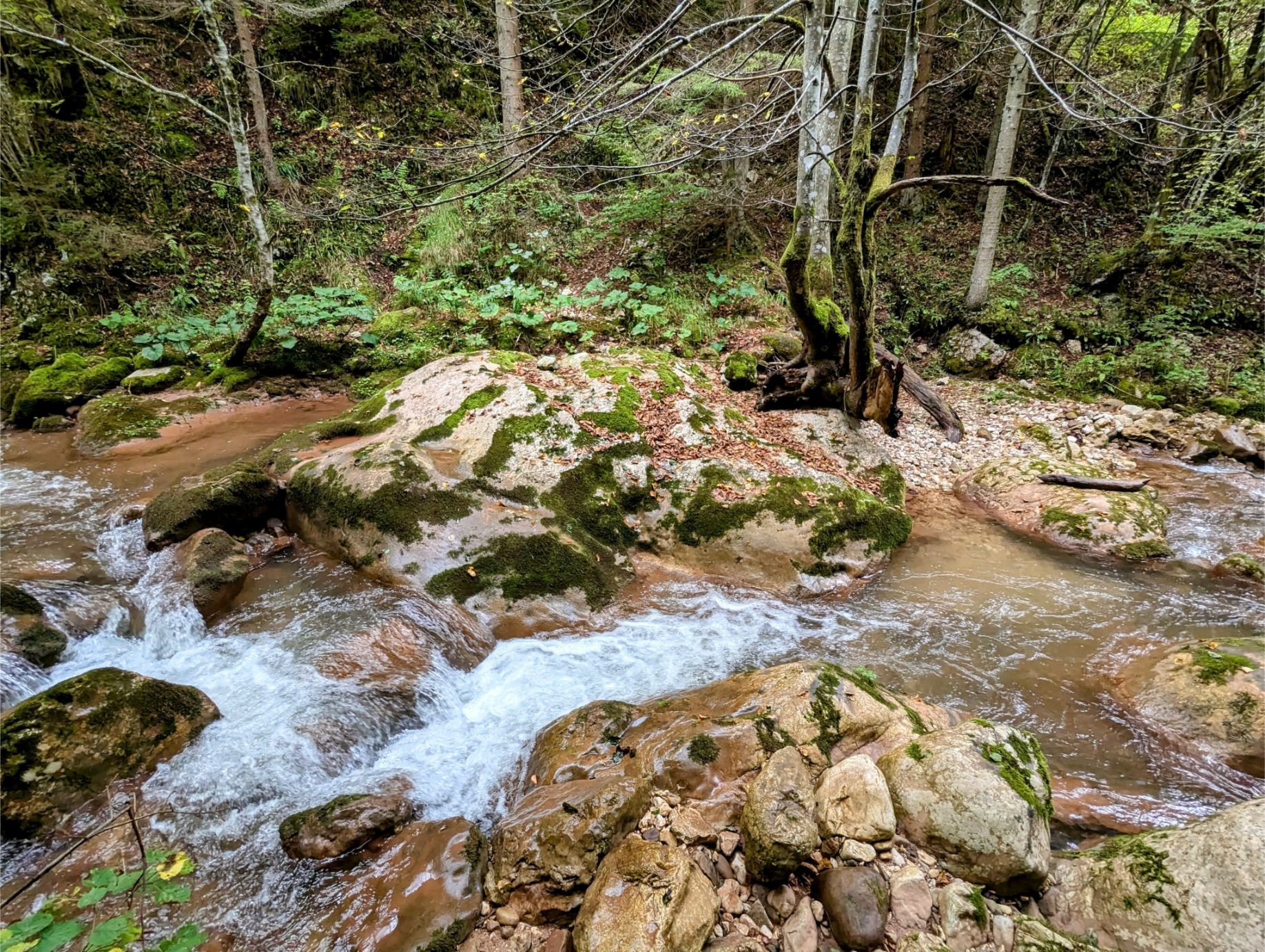
The trail then levels out and leads to a waterfall. It is less impressive than normal due to the lack of recent rainfall.
The trail starts a gradual incline at this point, back to where we entered the nature preserve.
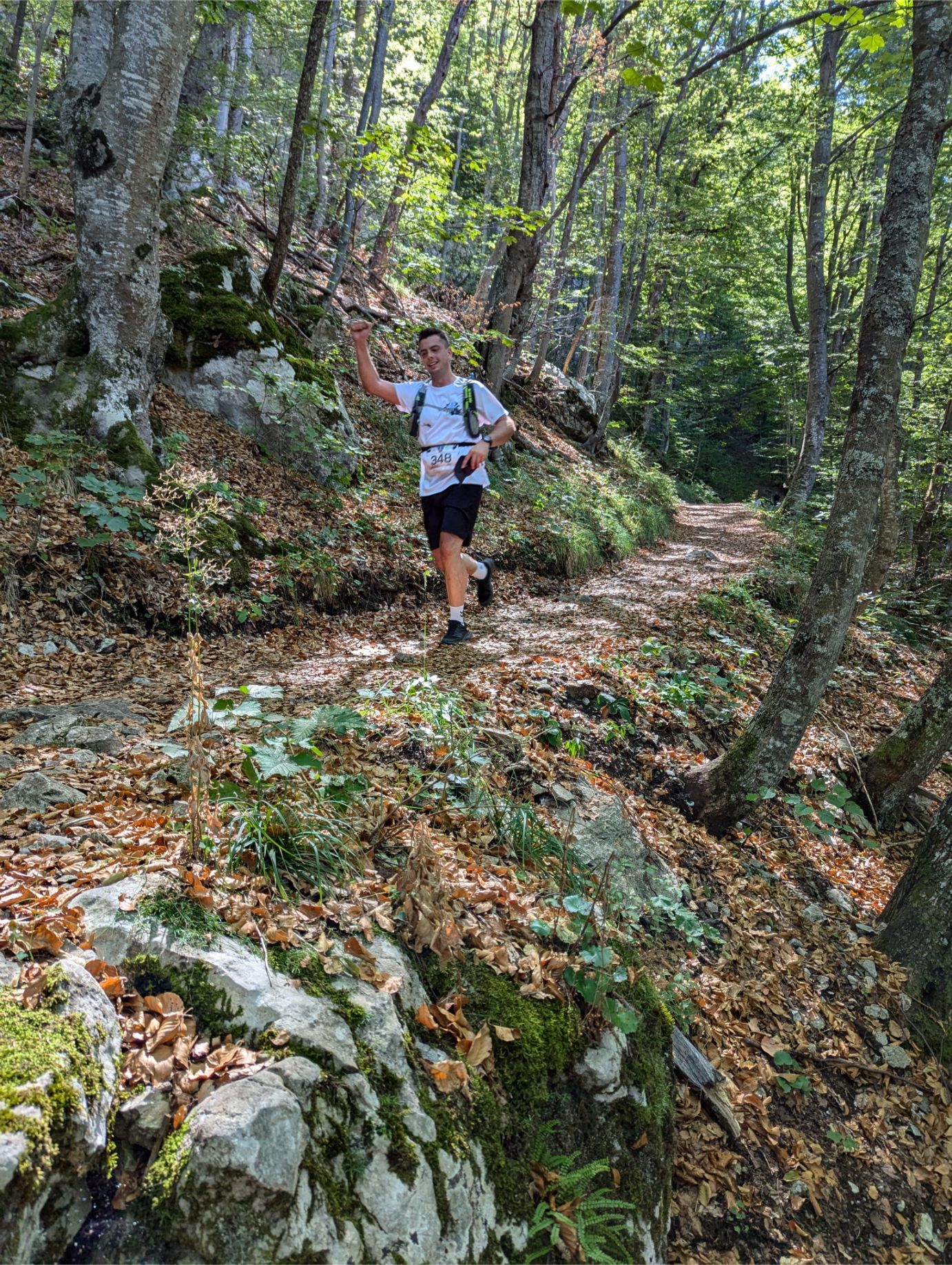
Fun fact – we had to dodge competitive trail runners for the last third of the hike! This was a race day apparently.
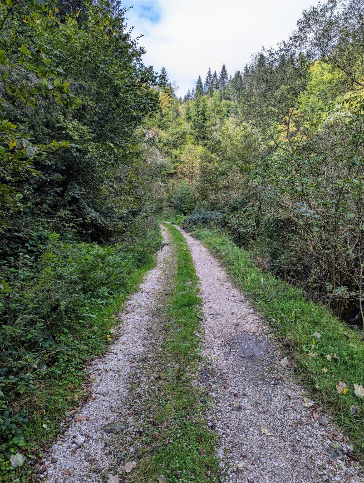
Pale to Sarajevo City Hall Abandoned Railway Trail
At 8.82 miles long with a slow descent from beginning to end, the Pale to Sarajevo City Hall Abandoned Railway Trail is easy – except when it isn’t!
The trail begins at Pale Bus Station, in the nearby town of Pale. From there you walk to the trailhead of an abandoned railway track that leads all the way to Sarajevo.
It is a fantastic hike. And aside from the distance and a few dodgy areas, the trail is extremely easy. The hike first takes you through the quaint streets of Pale, which looks to be a ski town of sorts. You’ll eventually reach a dirt track trail, which you’ll follow for the rest of the hike. But you should keep our map handy to help you deal with some of the problematic areas on the trail.
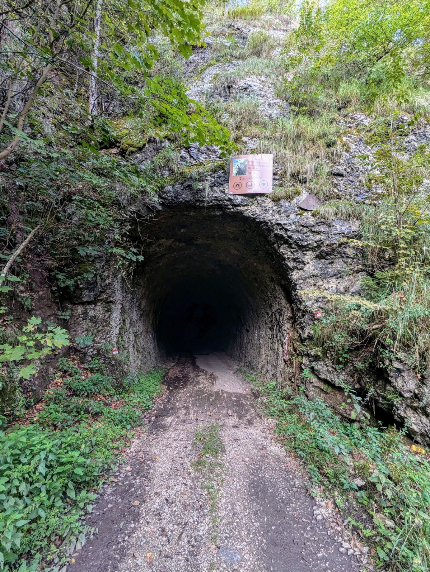
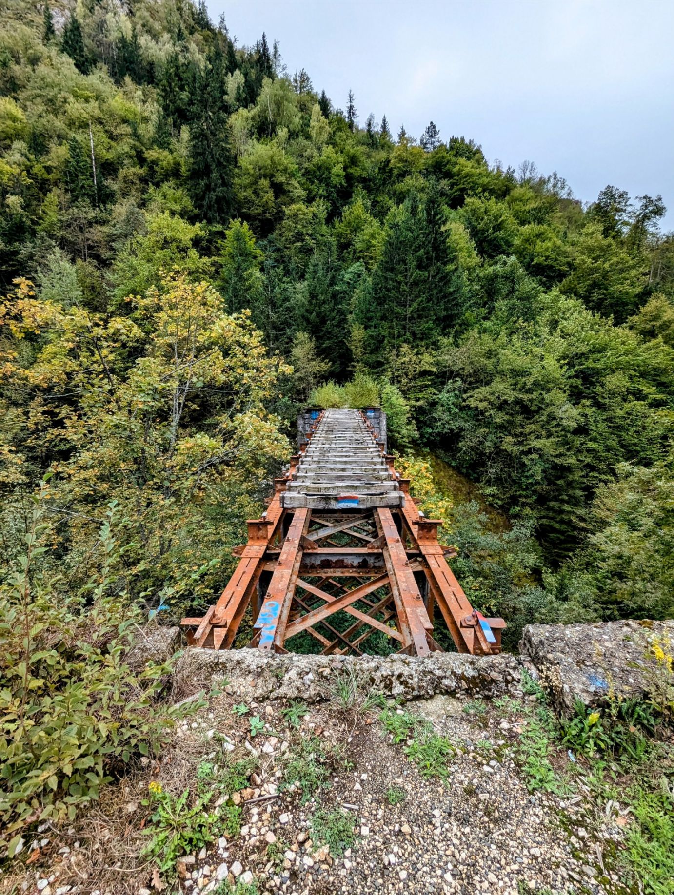
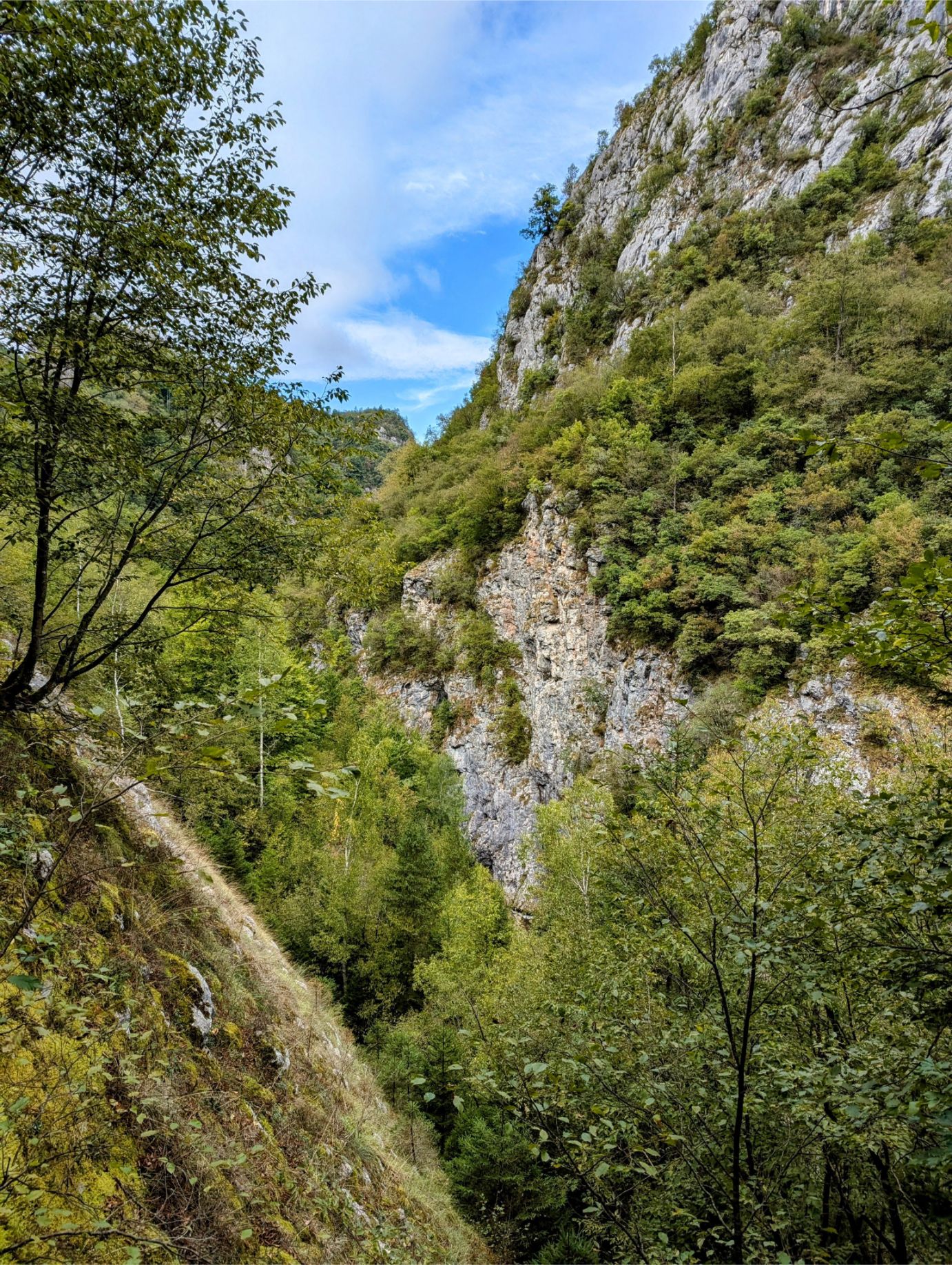
On this hike, you’ll be treated to lush forests, beautiful mountain scenery, high-altitude gorge views, abandoned railway tunnels (that you’ll walk through), overlooks, and railway bridge crossings. It’s the bridge crossings that can cause problems since two of the three bridges have structural issues and require detours. And the third bridge you’ll have to cross – there is no alternative.
The trail ends in Sarajevo, near city hall, so just walk home (or take public transportation) from there.
GETTING TO THE PALE BUS STATION:
The Centrotrans 18-ME bus (Sarajevo – Pale route) departs from Sarajevo Bus Station to Pale Bus Station Monday through Friday at 10 am. The only other M-F departure is at 4 pm, which is too late for this hike. There are no weekend departures. But be sure to verify all departure times with the Centrocard app just in case.
Just go to the ticket booth at the Sarajevo Bus Station and ask for one-way tickets, which cost 6.30 BAM ($3.59 USD) per person.
Then sit back and enjoy the pretty ride to Pale!
NOTES:
As I said earlier, this trail is easy except when it isn’t.
Here are the potential issues:
Issue 1 – You will be walking through abandoned railroad tunnels of different lengths. Some of them are long and pitch black inside! A cellphone light is all you need to navigate safely though.
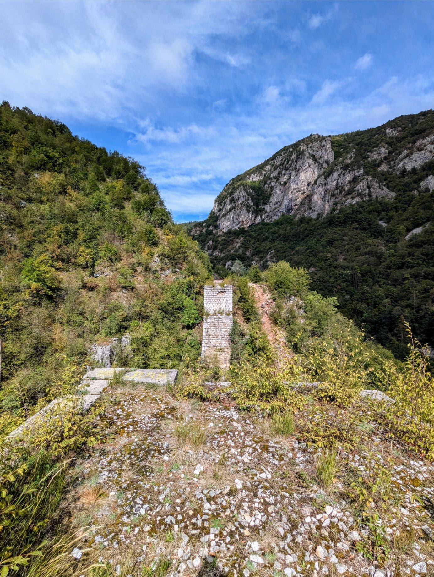
Issue 2 – The railroad bridge at map waypoint 1 is not structurally sound for crossing (see photos). Just follow the detour, but be aware that you’ll have to cross a stream (see photos) to continue the hike. If it didn’t rain the night before, the stream crossing should be pretty easy if you are careful.
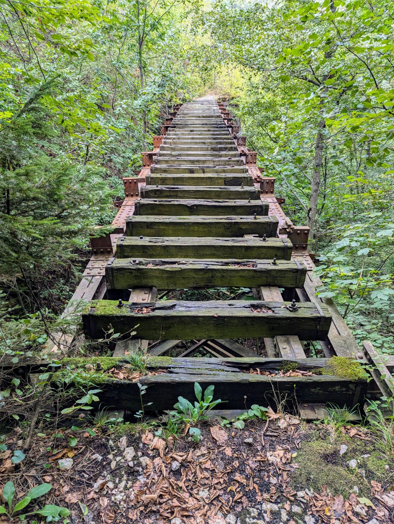
Issue 3 – The railroad bridge at map waypoint 2 is intact (see photos), but it is high above the ground and is scary to cross. Especially with no guardrails! We crossed by going slow, crawling on all fours when needed, and were fine. But be warned – it is a scary crossing! If you are afraid of heights, this crossing may be a hard pass for you. Sadly, there is no other way to get across the gorge.
Side Note– The bridge detour at waypoint 3 is easy. Just follow the trail map.
So if you don’t want to deal with these issues (especially the bridges), what can you do?
Simple. Walk the trail in reverse.
Start the hike at Sarajevo City Hall and walk to the Abandoned Train Station (waypoint 5) – or possibly the bridge lookout at waypoint 4. Then turn around and walk back to Sarajevo. The only downside is you’ll get hit with elevation gain walking from Sarajevo to the beginning of the abandoned track.
OUR HIKE PHOTOS:
Walking through the neighborhoods of Pale to get to the trailhead.
The official “trailhead” begins as a dirt track road. There is no signage or anything like that, so be sure to download our trail map data.
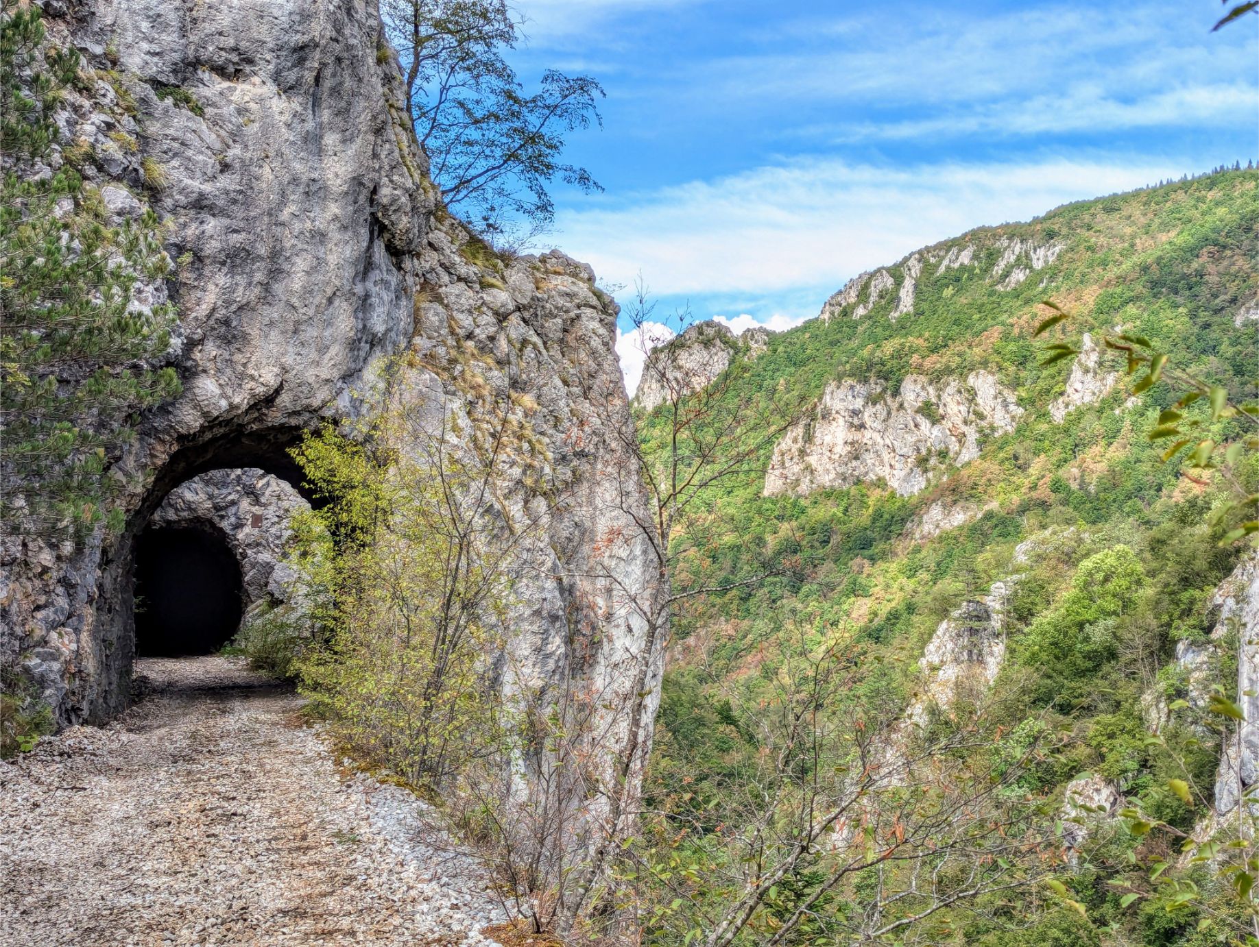
The first of many railroad tunnels. Hope your cellphone has a light!
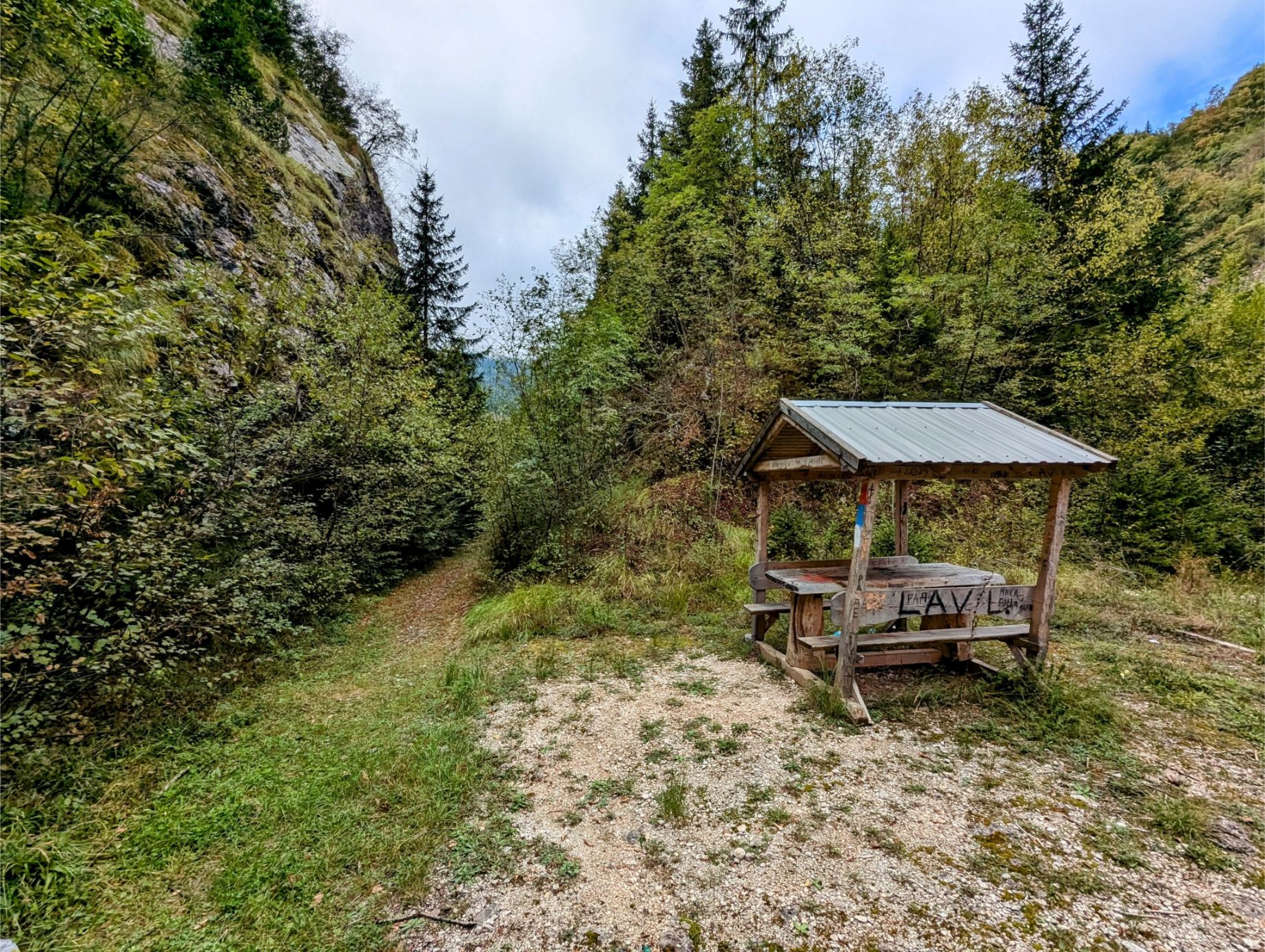
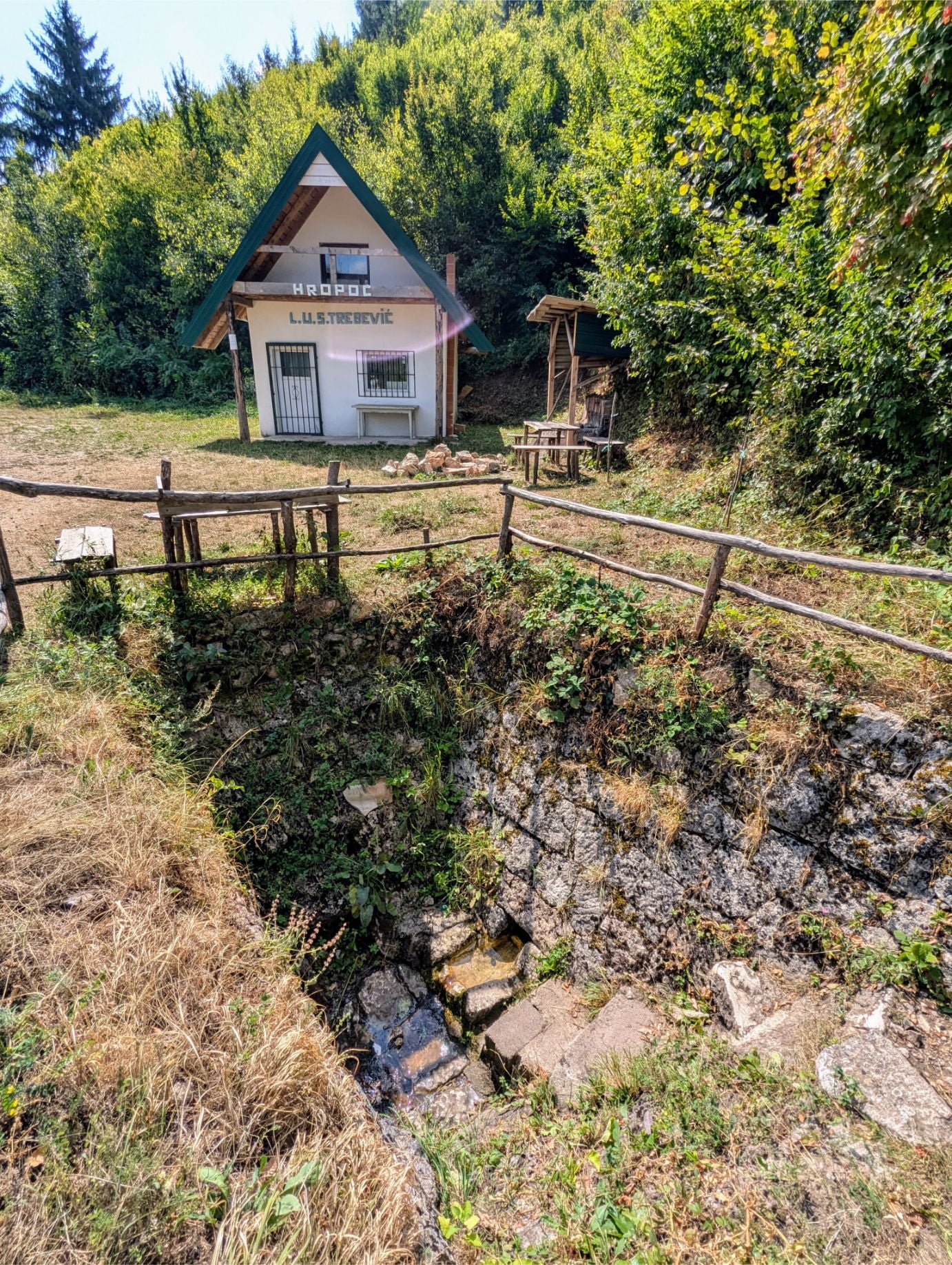
The trail goes by this picnic shelter, which we took advantage of for lunch.
The railroad bridge at map waypoint 1 has issues. Following the trail map to the stream crossing is the safe alternative.
Where you’ll cross the stream. There was quite a bit of water since it had been raining steadily for several days prior, but we were able to cross safely. And if we had to, we would have removed our boots and waded across.
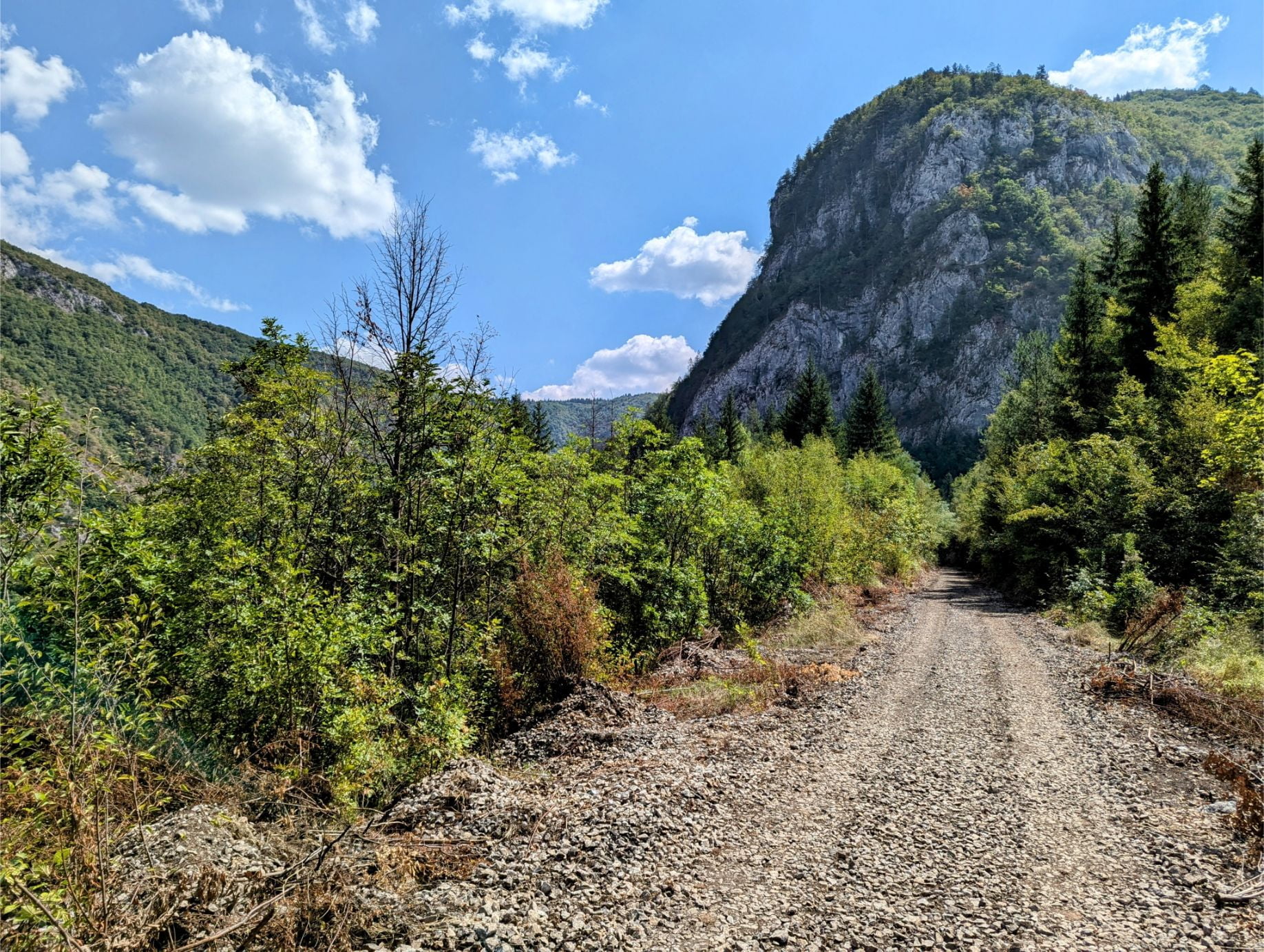
Continuing along the railroad track, views like this are common.
The second railroad bridge at map waypoint 2. This is the ONLY option for crossing the gorge. We were careful and made it across without issue.
Continuing onward, the view never disappoints.
The railroad bridge at map waypoint 3 is completely gone! A great overlook is on the other side (waypoint 4). Thankfully, the crossing detour is safe and easy.
Our favorite double tunnel, just after the third bridge.
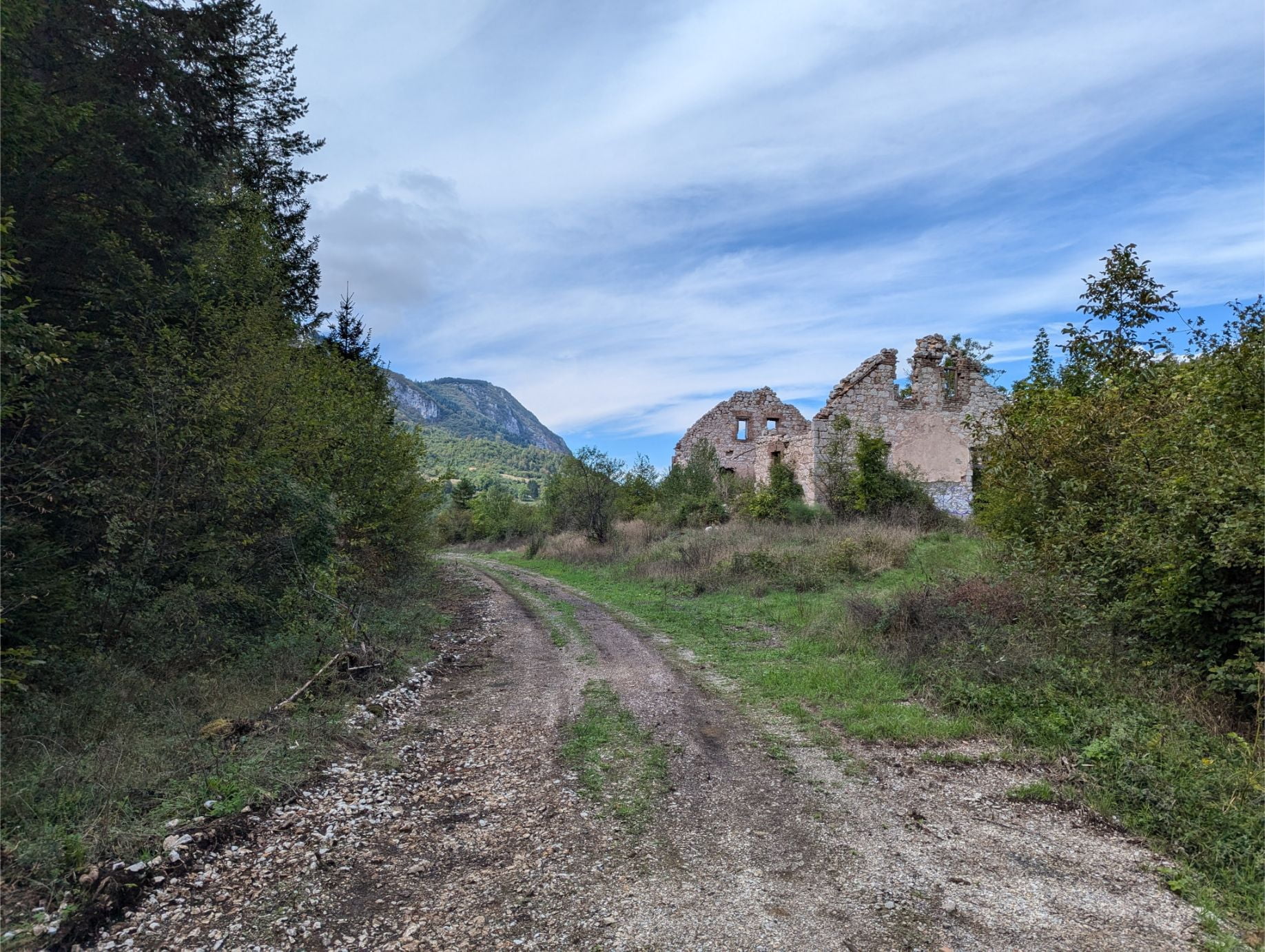
An abandoned railroad station at map waypoint 5.
Looking back on our progress.
A shelter area, near the end of the abandoned railroad track. Several structures for picnicking can be found here.
Closing Thoughts
As you can see, there are some great hikes within easy reach of Sarajevo. No car needed!
We’ve thoroughly enjoyed our time hiking the trails, and wish our final week in Sarajevo had better weather. We’d have even more hikes to talk about!
Hopefully, readers thinking about coming to Sarajevo will find this information useful and will get you out on the trails.
Until next time…
Thanks for reading!
If our posts have saved you time, money, or are enjoyable in some other way, BUY US A COFFEE! It helps cover the costs of our blog, keeps our blog ad-free, and motivates us to continue posting about our experiences.
And leave a comment below and subscribe to get email notifications whenever we post!


")
")
")
")
")
")
")
")
")