As we said in our last post, we’ve been hiking a lot during our month in Sarajevo, Bosnia & Herzegovina. To be honest, all our hikes here have been fantastic. But the crown jewel has been the Umoljani Lukomir Trail in the Dinaric Alps, one of the most visually spectacular in all of B&H.
It was quite the workout, but we wanted to share what we did and how we did it, to encourage others to hike this trail as well!
It was so worth the effort.
The Umoljani Lukomir Trail
Nestled in the Dinaric Alps, the Umoljani Lukomir Trail is considered by many to be the most beautiful mountain hike in all of Bosnia & Herzegovina. And despite this, it is only 45 kilometers from Sarajevo by car.
Here is an interactive map of our trail route:
This circuit hike will give you a workout, being 10.2 miles (16.4 km) long with ~3,000 feet (914 m) of elevation gain.
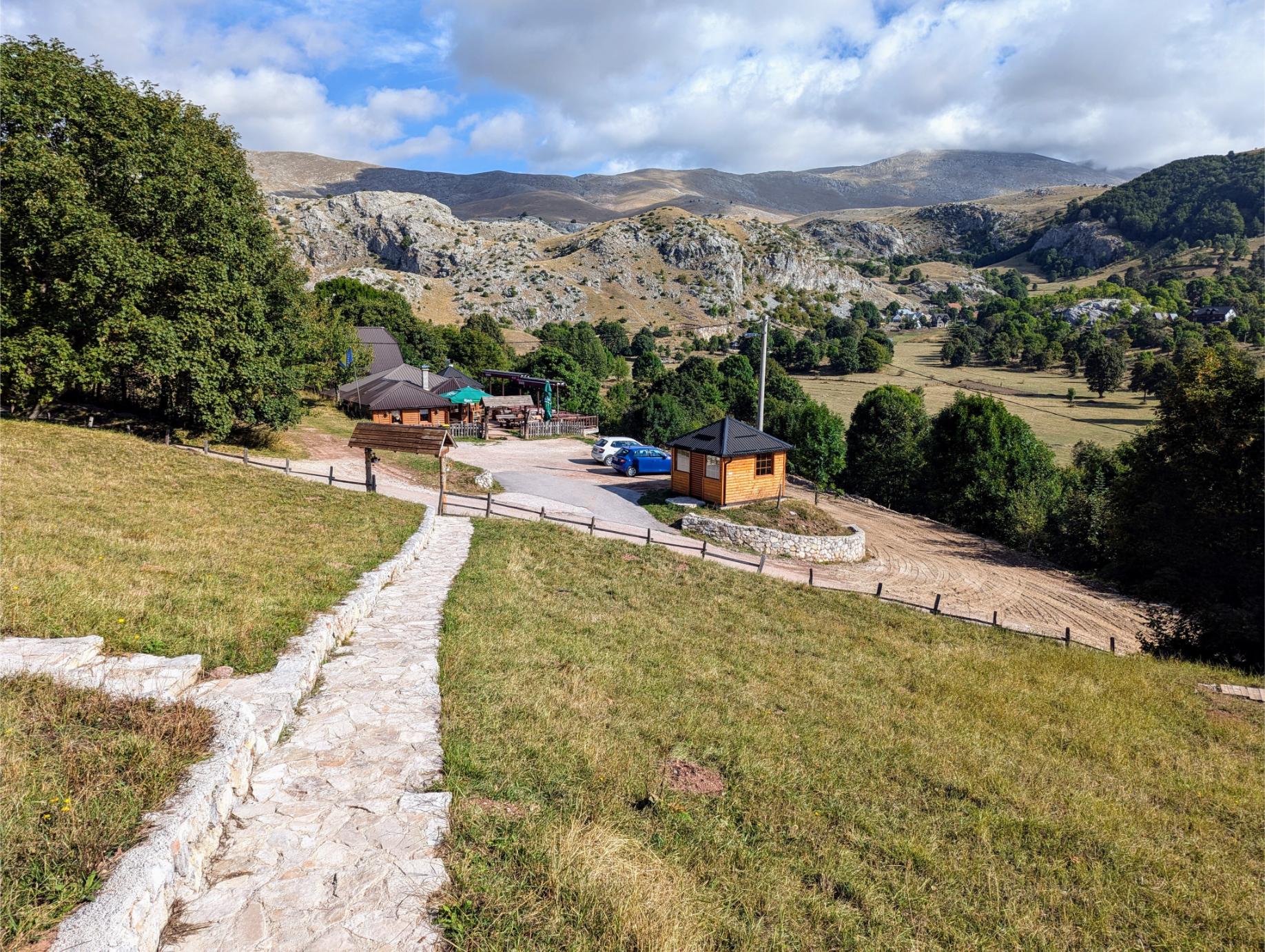
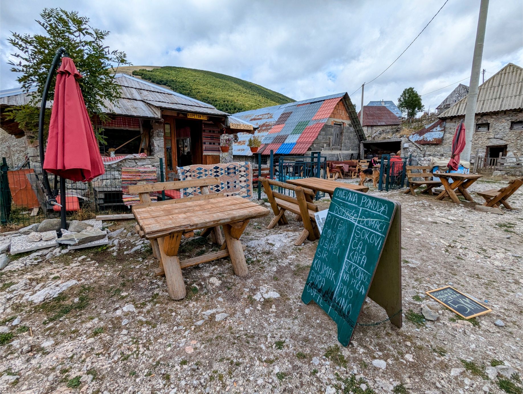
You have to drive to the village of Umoljaniand park in the Koliba Umoljani cafe parking lot to reach the trailhead.
The Koliba Umoljani cafe parking lot. They encourage hikers to use it!
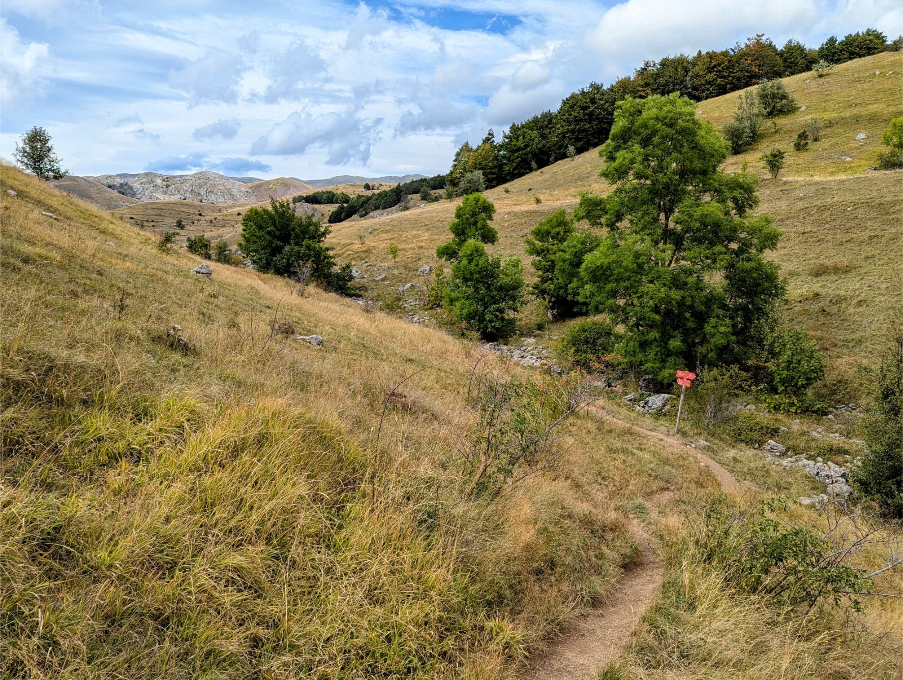
From here you follow the map route uphill until you get to the circuit portion of the trail.
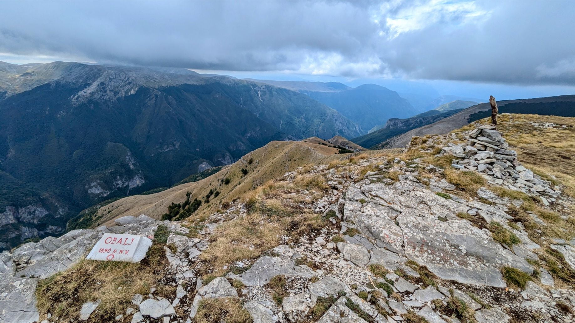
You should follow the circuit counterclockwise. You will walk through valleys, along ridgelines, and eventually to the summit of Obalj (6,221 feet elevation).
The majority of the elevation gain takes place from the trailhead to the peak of Obalj, which is good because the incline is less severe in this direction and your legs will be fresh.
From Obalj, you descend to the medieval village of Lukomir, the most isolated settlement in all of B&H.
It is a unique place and was even featured in an article by National Geographic. In Lukomir you can grab lunch at one of the cafes and soak up the views before returning to Umoljani.
The trail from Lukomir back to Umoljani takes a different route than the one that brought you there, which thankfully is downhill or level most of the way.
The hike took us a total of 6.5 hours. We started hiking at 9:30 am, took a lunch break on a ridgeline with a view at 11 am, took a coffee break in Lukomir at 1:30 pm, and finished the hike by 4 pm.
We then got refreshments at Koliba Umoljani before driving home. It’s the least we could do for using their parking lot, which they encourage since hikers make up most of their business.
Download Our Trail Map Data Before You Hike!
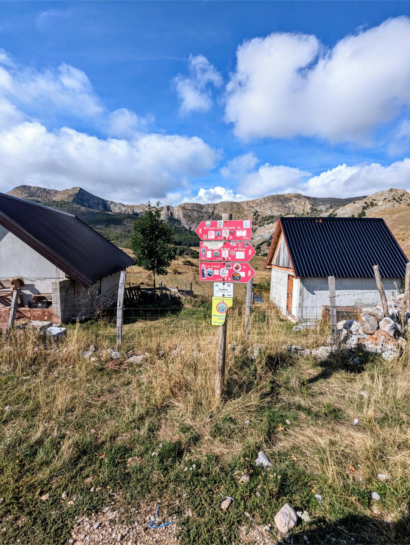
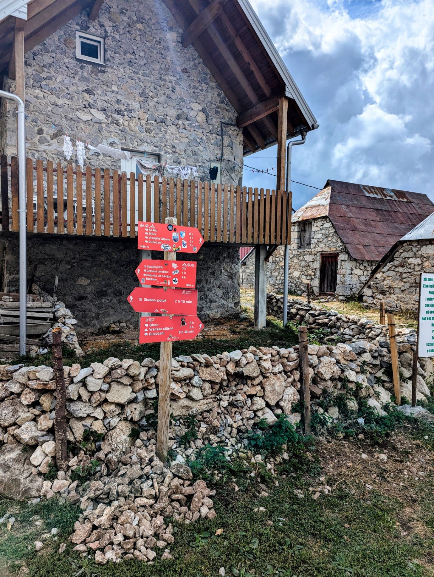
NOTE: the portion of the trail from Umoljani to Lukomir is very poorly marked and you WILL miss turns without smartphone app assistance.
This sign at the beginning of the circuit portion of the trail is the only sign you’ll see until you reach Lukomir! Be sure to download our trail map data before you start the hike or you WILL get lost.
Download our trail map data (see links below) and upload it into the offline-functional trail app of your choice so you don’t miss a turn!
Our preferred free app is maps.me, which accepts KMZ file formats.
You need a reasonable degree of hiking fitness for this circuit trail.
But if you can walk 10 miles comfortably on level ground you should be able to manage as long as you take your time, rest when needed, and hydrate as you go.
By amateur hiker standards, this trail is considered moderate as the elevation gains, downward descents, and trail conditions do not require special training or technique.
But make no mistake, you will feel the burn toward the end! The effort is worth it though.
Since the trail is in a mountain range, we checked the weather in the area two days ahead before committing to the hike (and a rental car). This is NOT a trail you want to hike in bad weather!
The trail is largely exposed to the elements, so preparations need to be made accordingly.
We brought daypacks with sunscreen, hats, sunglasses, and layered, convertible clothes to protect from wind, cool temperatures, and potential rain. We also brought snacks and 1.5L of water each.
And of course, we had proper hiking boots. But any shoes with aggressive tread should be fine.
Getting To The Umoljani Lukomir Trail
For the first time in our travels, we were forced to rent a car for one of our day trips.
No bus or train comes close to Umoljani or Lukomir. And hiking tours are way too expensive at €70 per person.
Renting a car in the Balkans made us nervous at first, but it ended up being a really good experience!
Two days before our chosen hike date we used the car rental platform 365 Car Hire to book a rental car. The company we rented from was addCar, found at the Sarajevo International Airport.
Scheduled for a Thursday morning pickup, we booked a mini-sized car (manual transmission), with unlimited miles and basic insurance coverage included.
When we arrived to pick up our car, addCar upgraded us to an economy-sized car for free!
We just had to show the rental agent our USA driver’s license, our USA passport, and the credit card with which we made the original booking. I had my International Driving Permit too just in case, but they never asked for it.
And the cherry on top was that the car only cost $20.65 USD for the day, including the airport reentry fee. We were told by the agent who helped us that rentals can be as much as €50 per day during high season, so we were happy to have visited Sarajevo in September!
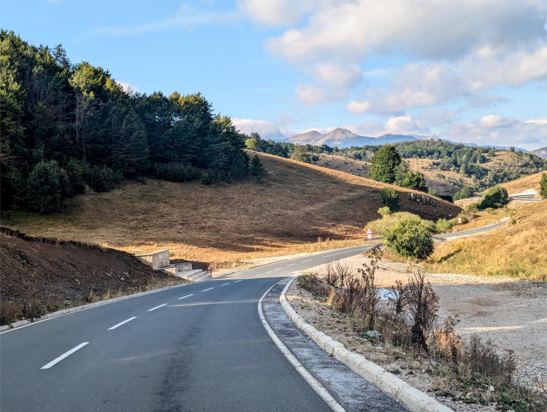
It was a beautiful, stress-free drive to the trailhead.
Speed limits were modest, making safe driving easy. The roads were in good condition and easy to navigate. Traffic was no problem. And driving in the mountains was a ton of fun!
Driving into ski territory.
Our road traveled in the distance. Almost at Umoljani at this point.
This was our driving route:
Two Travel Turtles Hike The Umoljani Lukomir Trail!
We had a fantastic day on the trails!
It was hard work, but it was totally worth it.
Here are some pictures from key points along our hike. We weren’t kidding when we said the views were spectacular!
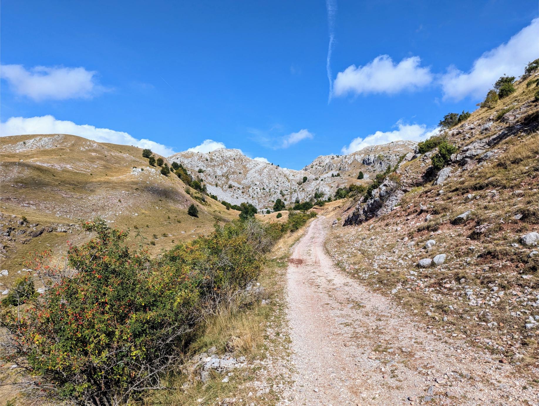
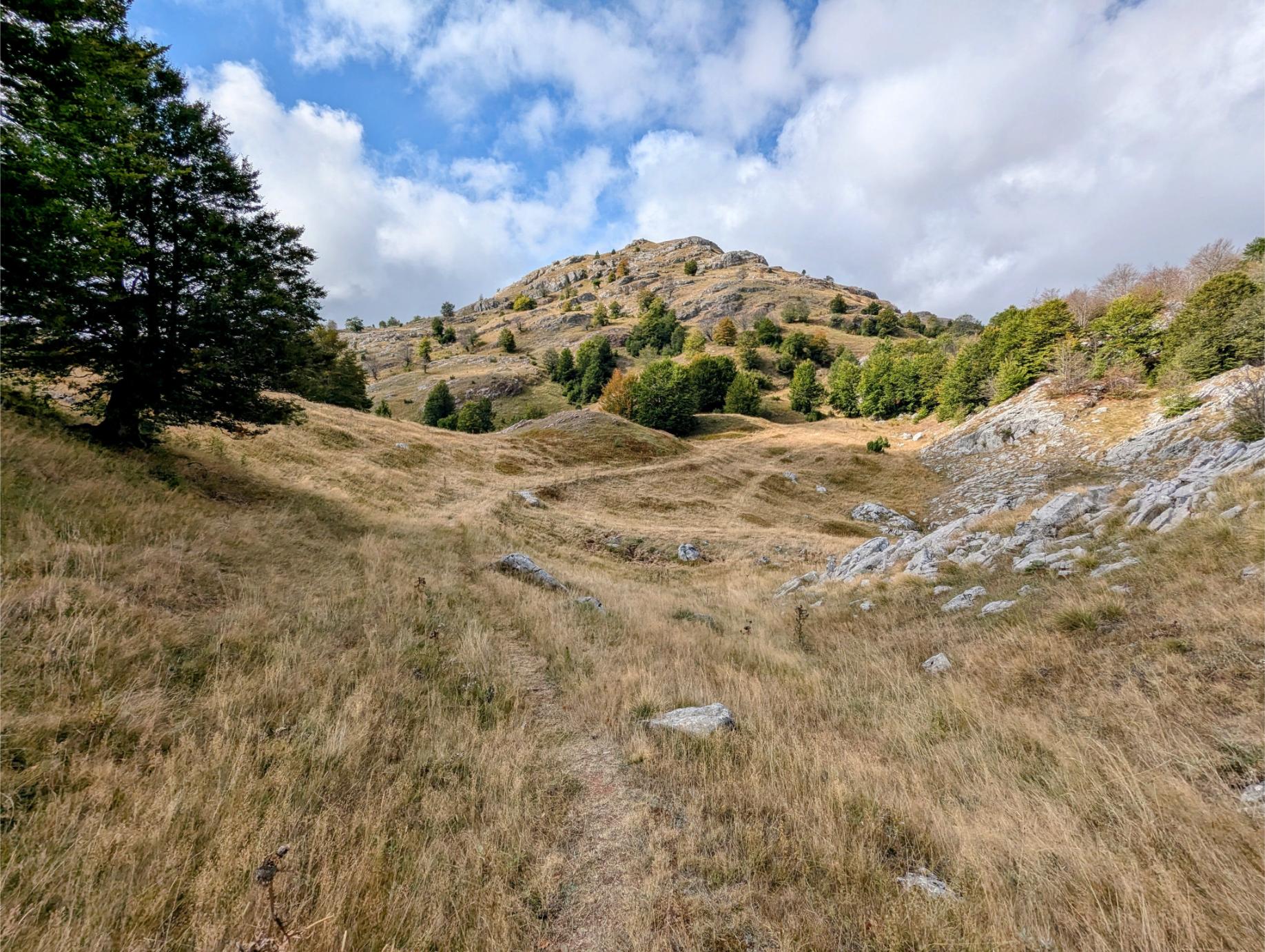
After starting the circuit portion of the hike (at the village of Gradina), the uphill climb begins.
The trail leaves the dirt road pretty early and leads to a series of peaks and ridgelines.
Looking back down the mountainside after a particularly nasty stretch of elevation gain.
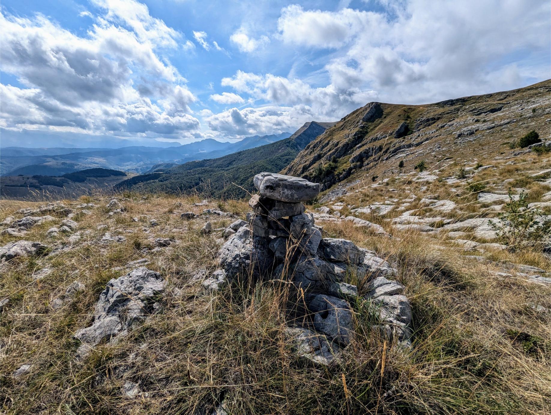
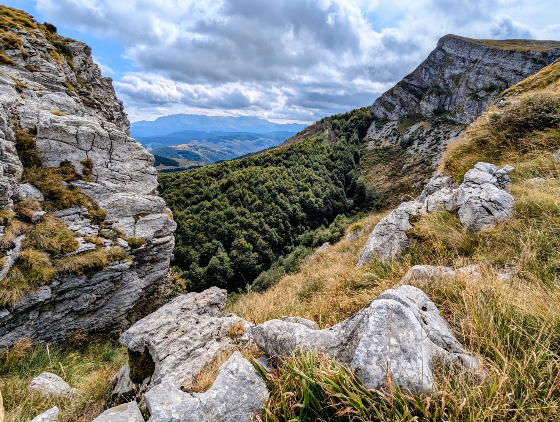
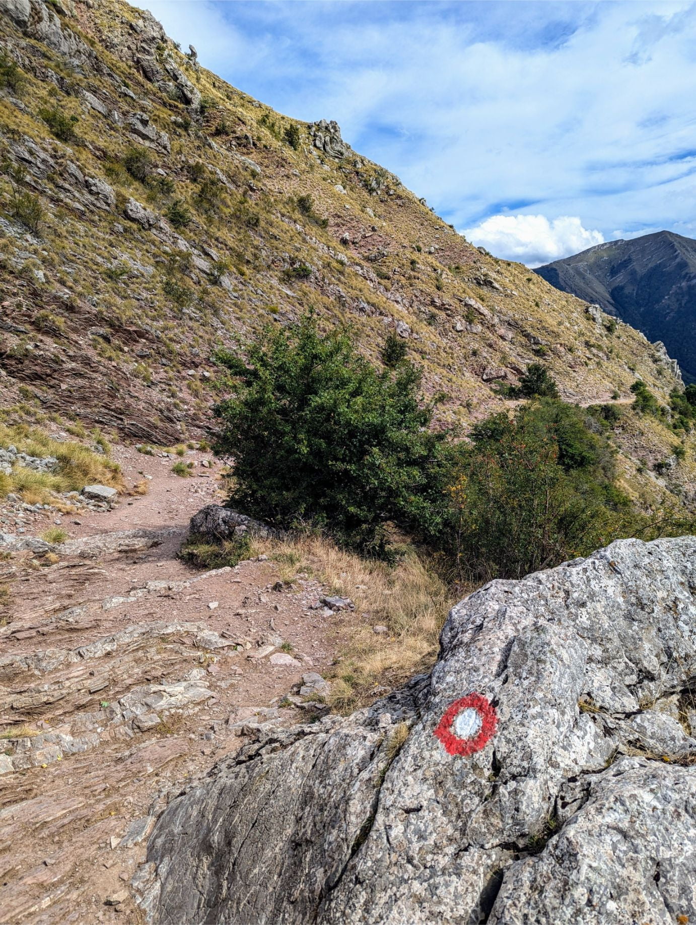
As you hike upward toward the ridgeline, the terrain gets more rocky. And you’ll start to see rock pile trail markers if you look for them.
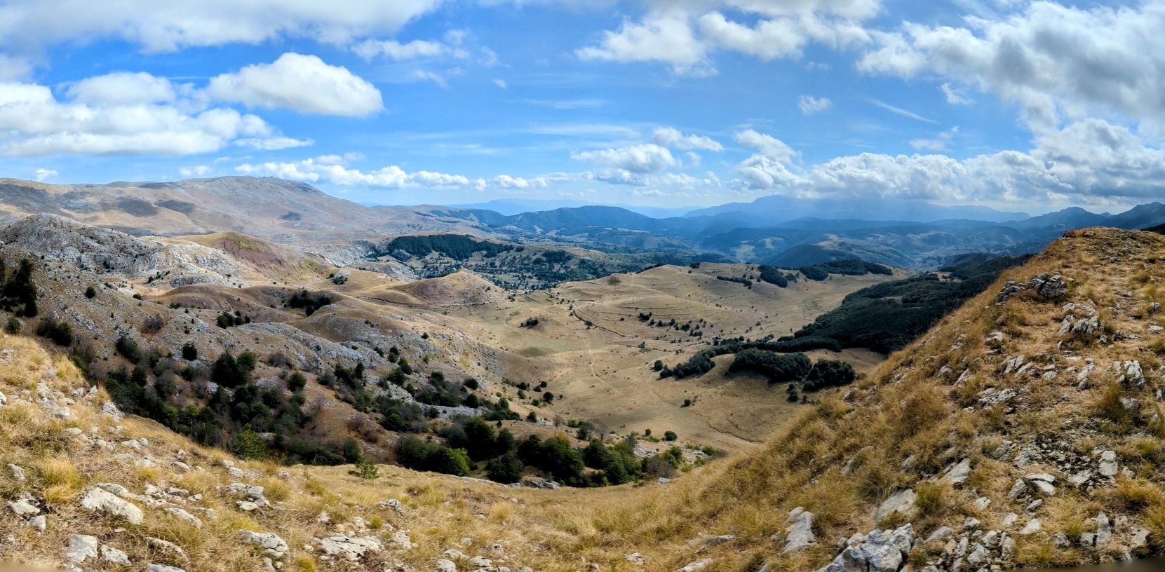
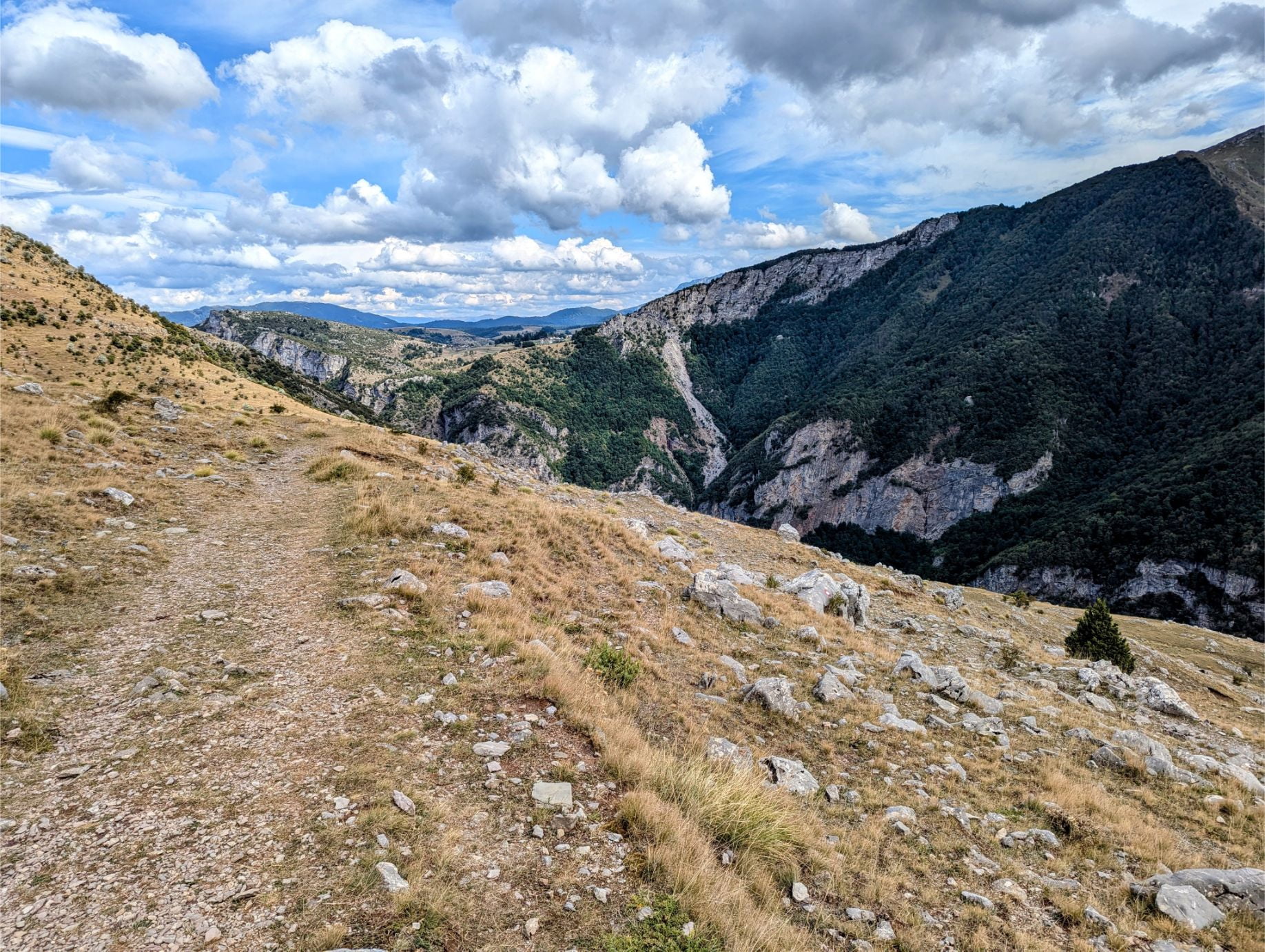
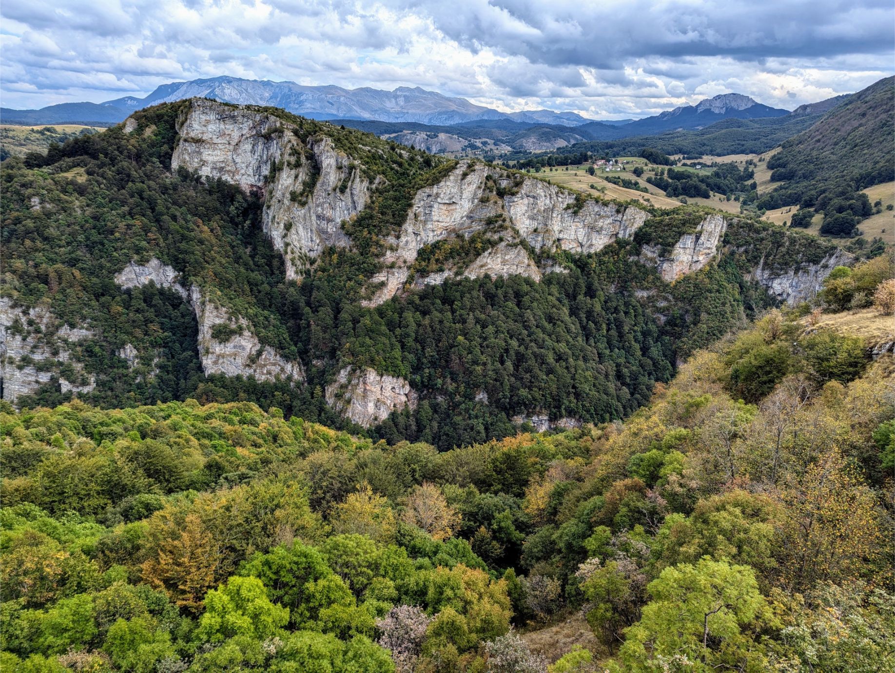
The panoramic view from the ridgeline here was amazing.
Looking backward, you can better appreciate the ridgeline we walked.
At this point along the ridgeline, we stopped for lunch and admired the view.
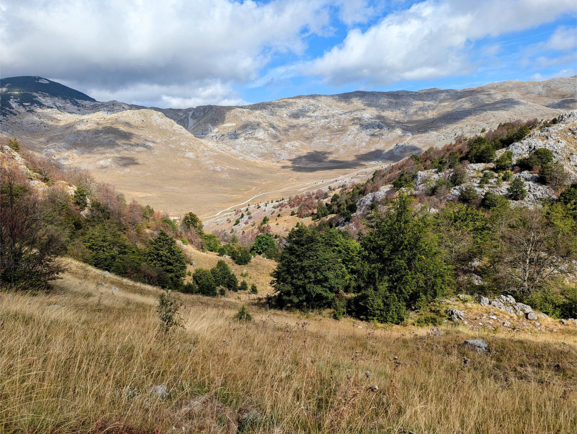
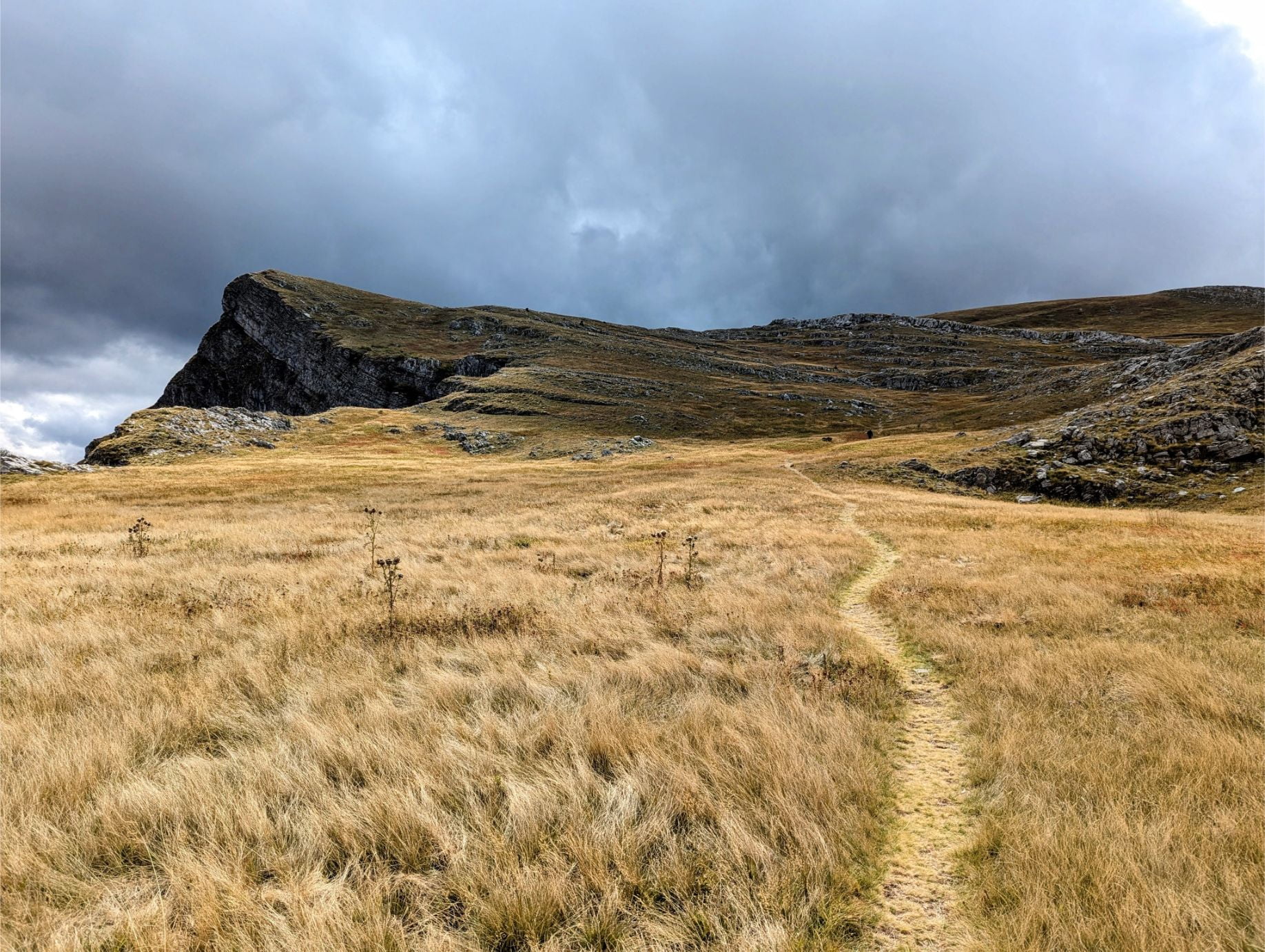
After lunch, the trail continued onward and upward. We were starting our approach to Mt. Obalj at this point.
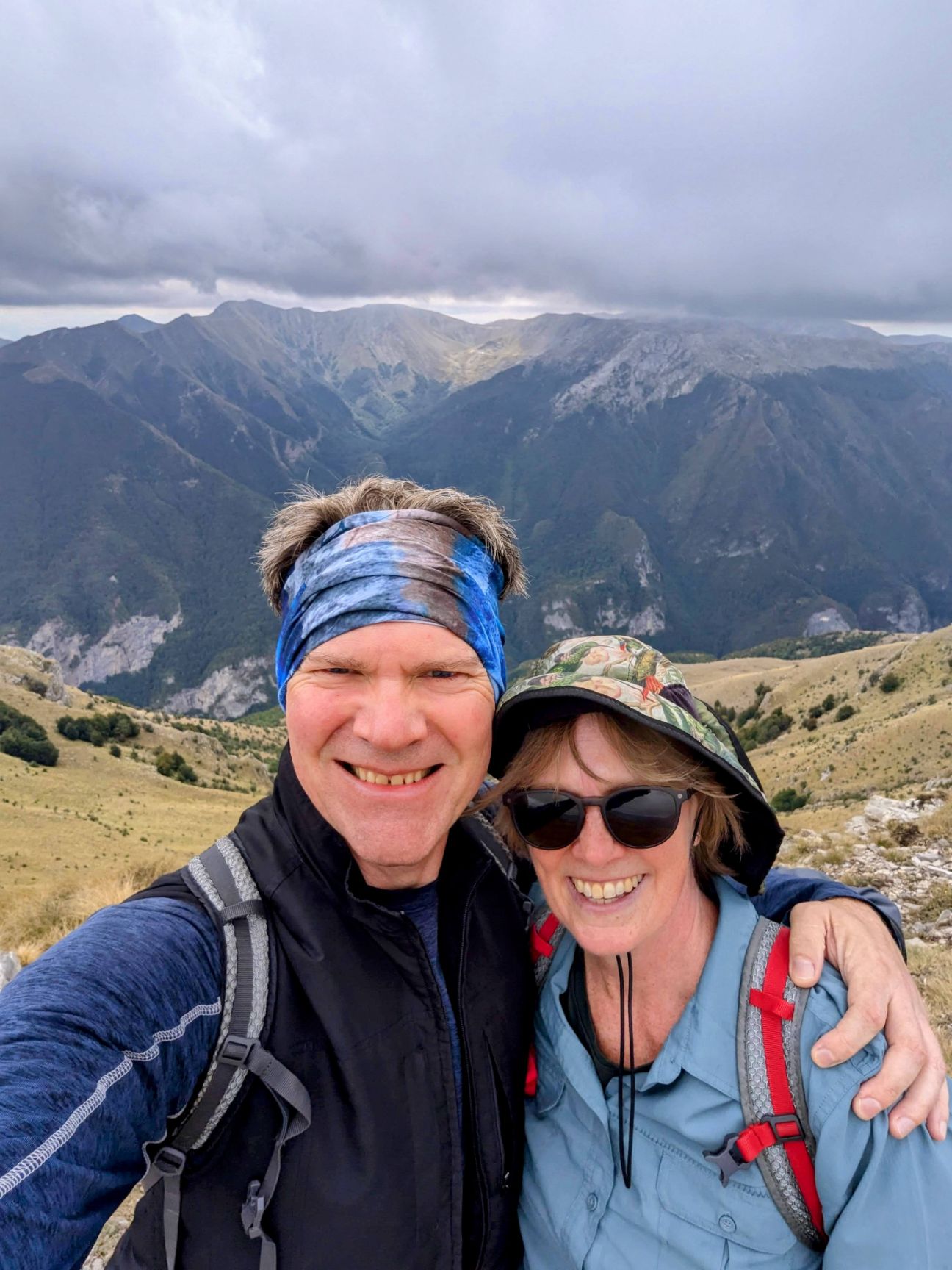
We made it to the peak of Mt. Obalj! At the highest point of the trail, the wind was pretty strong.
Victory selfie!
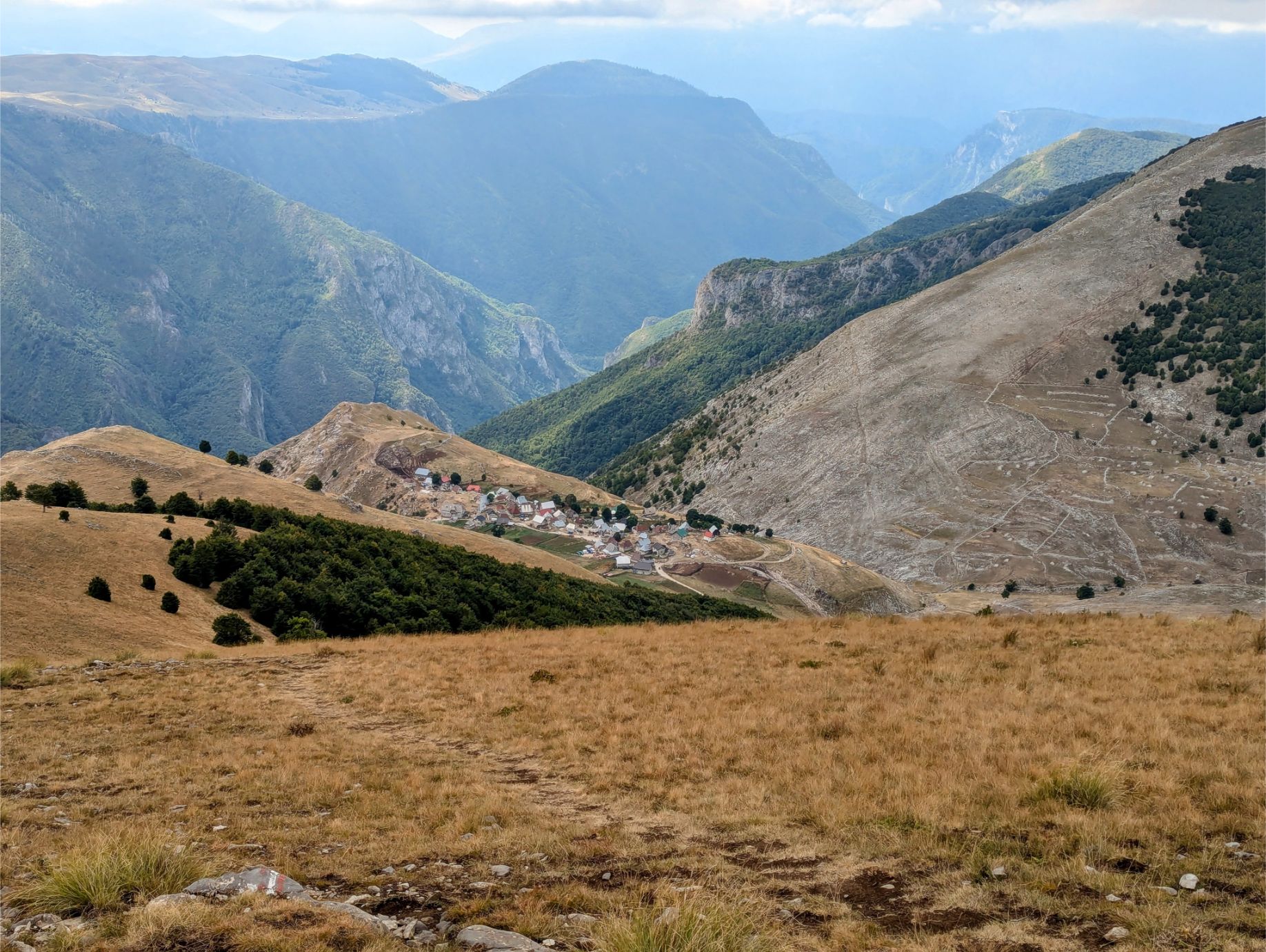
From the peak of Mt. Obalj, we could see Lukomir village in the distance. It’s further away than it looks!
Making the approach to Lukomir. We had been descending for at least 30 minutes at this point, and it would be another 30 minutes until we arrived.
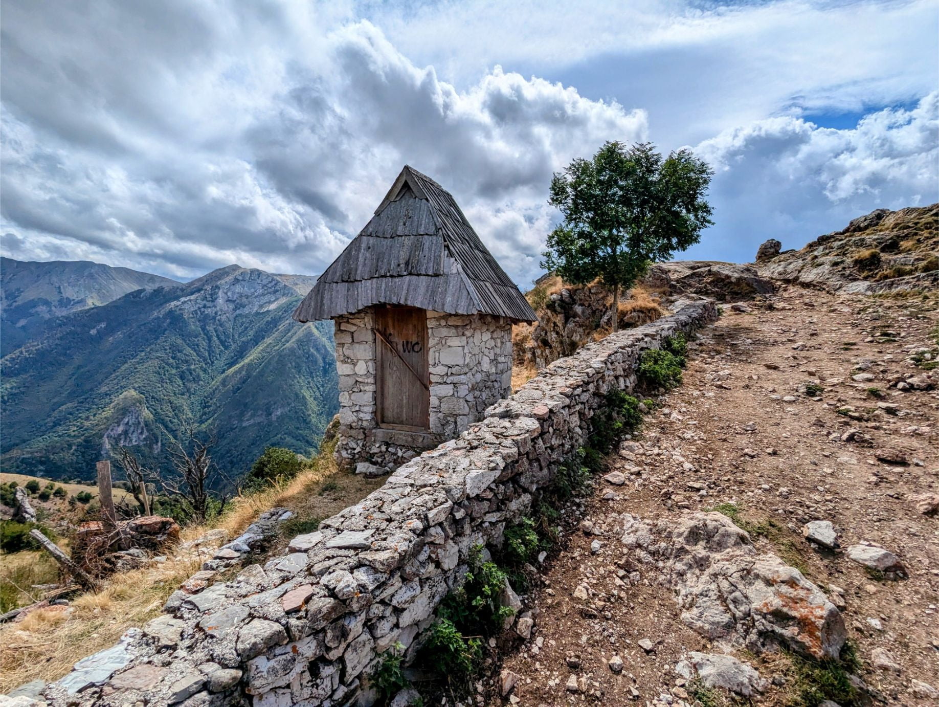
We first took a path to the Lukomir lookout point.
No shortage of panoramic views here!
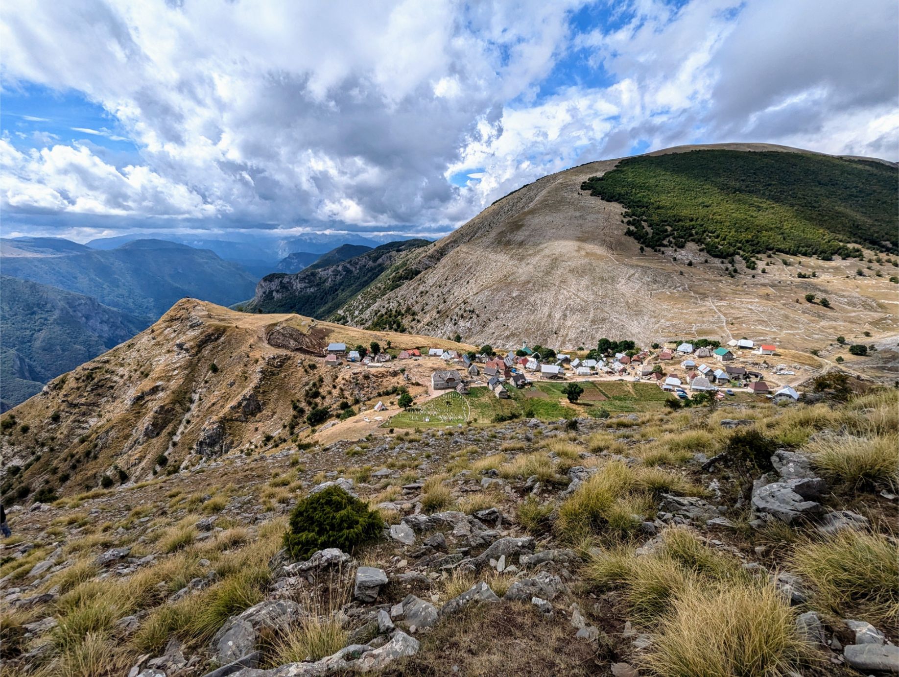
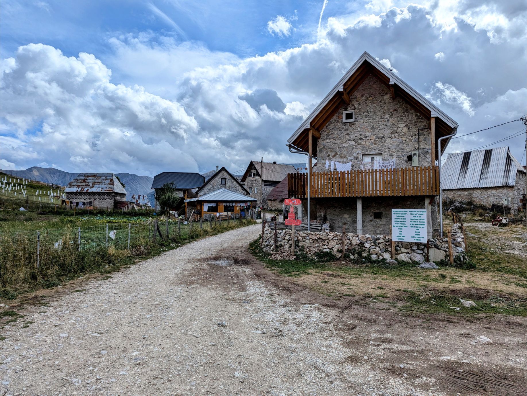
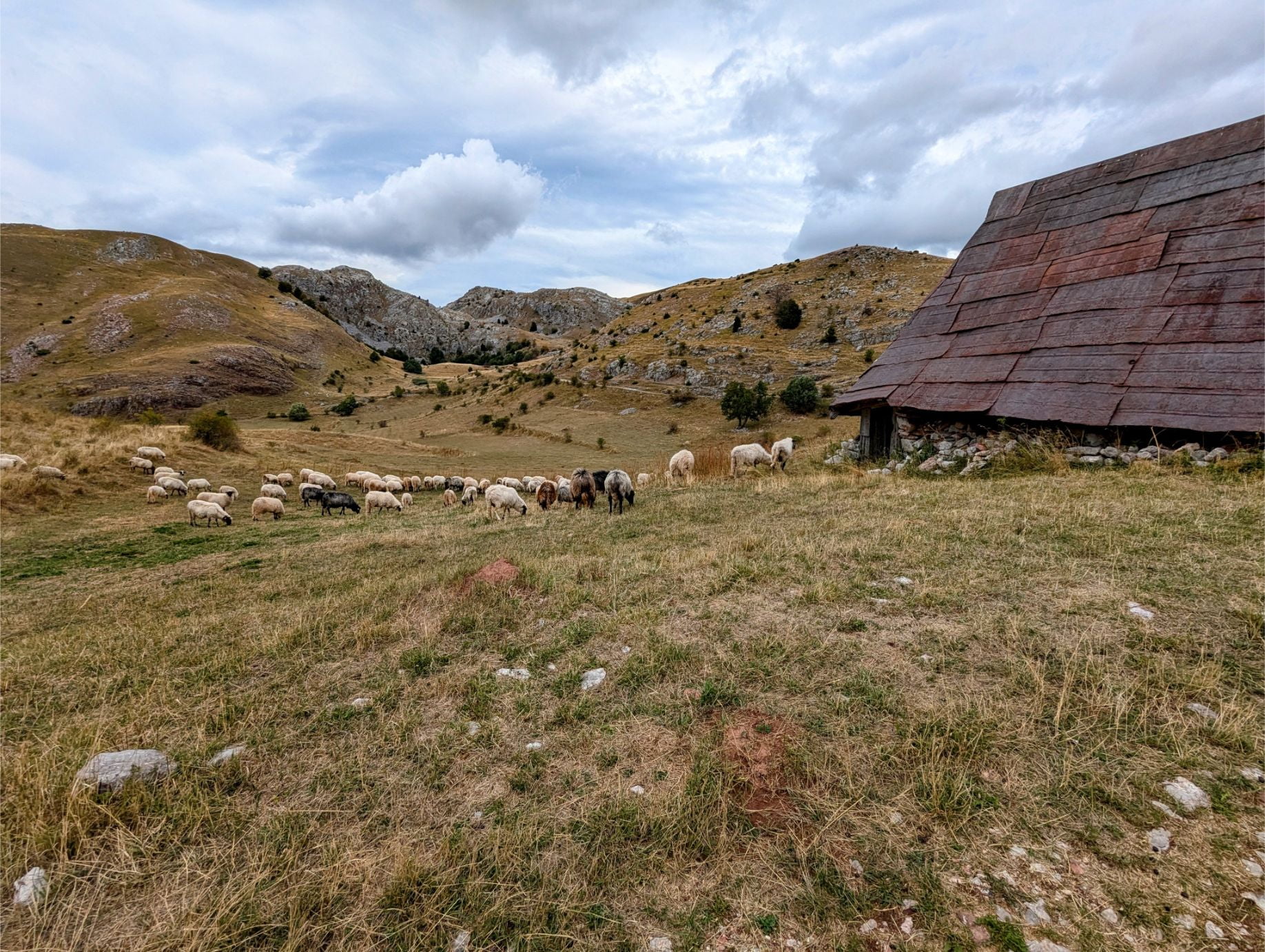
Lukomir is a sleepy little village only open in the summer and spring/fall shoulder seasons due to weather. There are a couple of cafes and hostels here, as well as locals selling handmade wool products.
It wasn’t until we reached Lukomir that we saw another sign for the circuit trail!
We took a break at a local cafe before continuing onward.
The return route to Umoljani from Lukomir is much better marked for hikers.
Although the majority of the return route is a descent, there is no shortage of beautiful views.
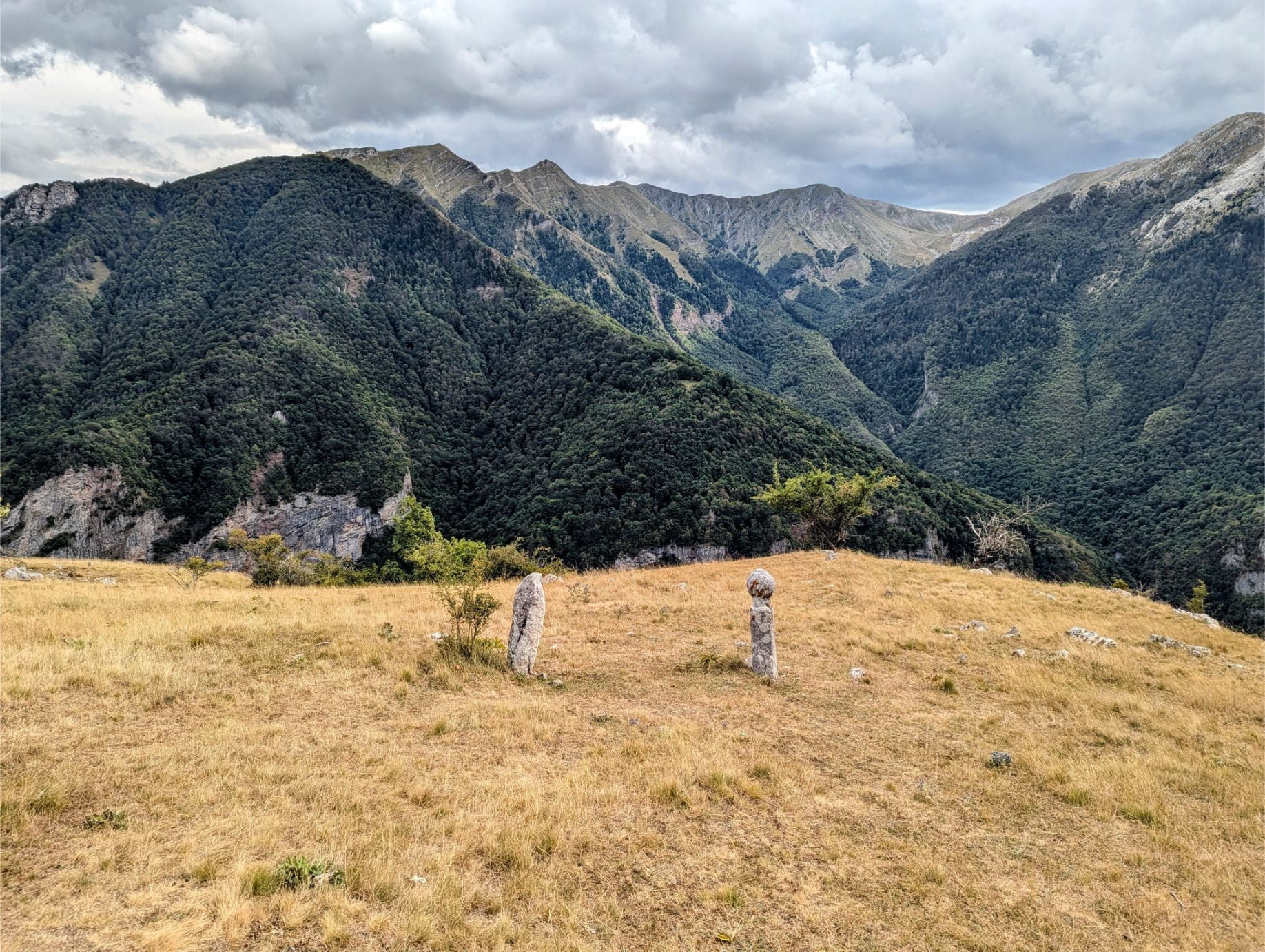
We saw gravestones from the trail. A beautiful place to be buried.
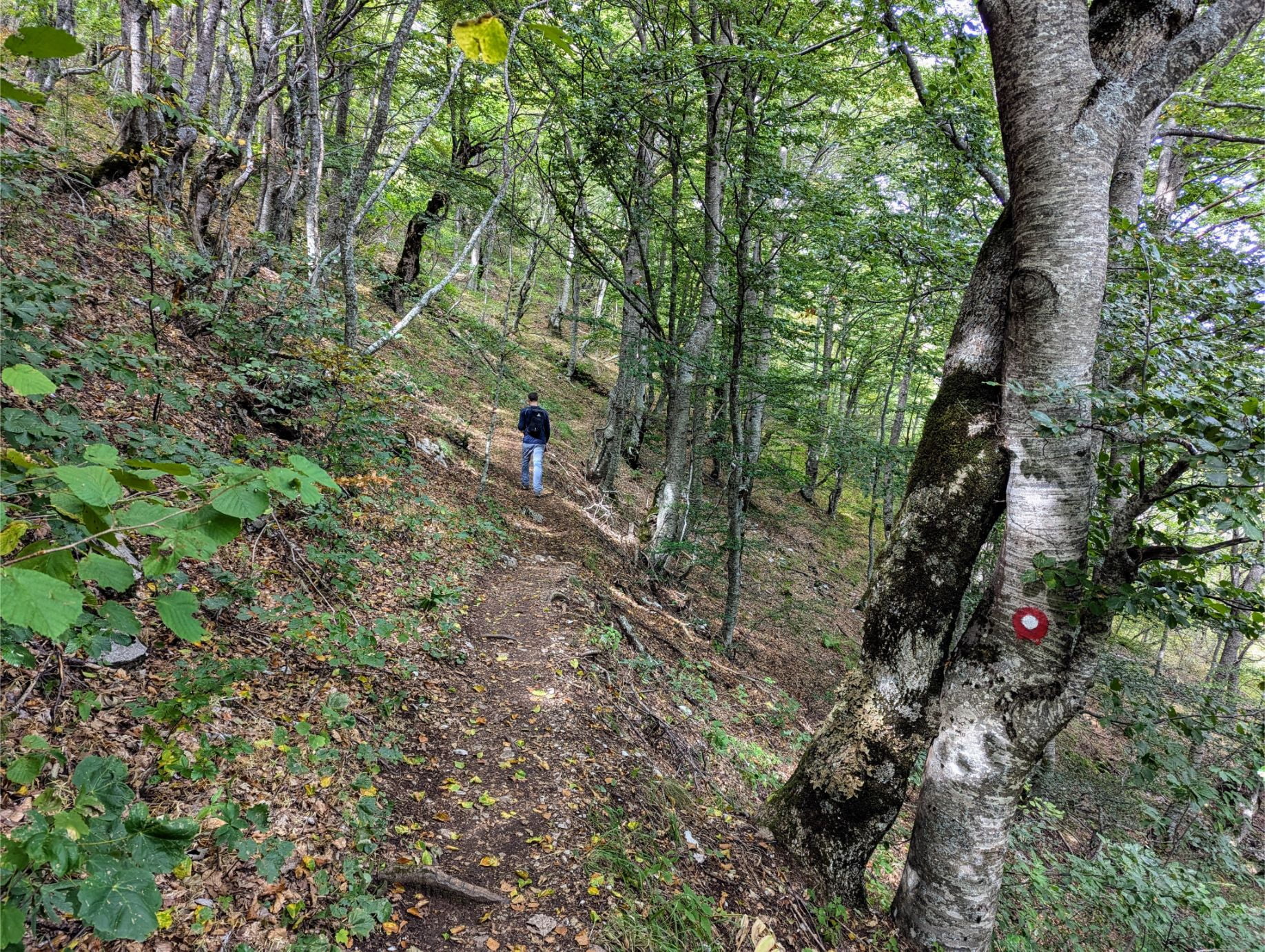
The environment changes significantly on the return route, with much greater forest density.
Making our way through the forest.
Entering the final stretch of the hike. Just a few more kilometers to go!
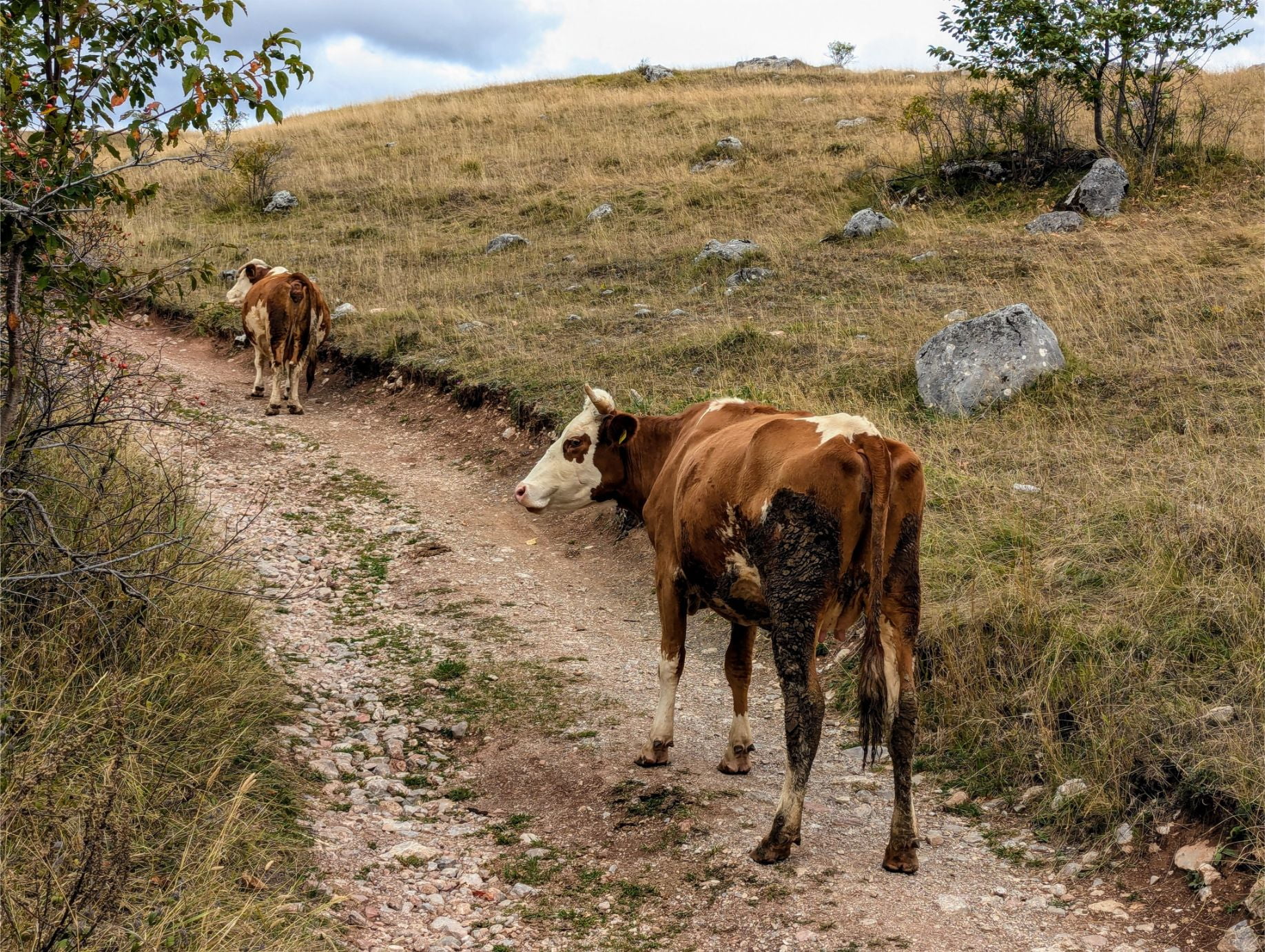
As we returned to the village of Gradina, the farm animals were making use of the trails.
Lots of sheep too! But from here we made our final descent to the Koliba Umoljani cafe parking lot. What a day!
Closing Thoughts
What a great hiking experience! The Umoljani Lukomir Trail is one of the best hikes we have ever done, for sure.
It is rare to take a hike where you are continually bombarded with epic views the entire route!
Highly recommended.
Hopefully you have found reading along with our experiences fun and (possibly) useful.
Maybe it will inspire you to hike the Umoljani Lukomir Trail for yourself if you are ever in Sarajevo!
Until next time…
Thanks for reading!
If our posts have saved you time, money, or are enjoyable in some other way, BUY US A COFFEE! It helps cover the costs of our blog, keeps our blog ad-free, and motivates us to continue posting about our experiences.
And leave a comment below and subscribe to get email notifications whenever we post!


")

")
")
")

")
")

4 thoughts on “Hiking The Umoljani Lukomir Trail (Bosnia & Herzegovina)”
Beautiful!!
Absolutely!
I’ve found that Organic Maps is now better than maps.me
Excellent! We’ll give it a try on our hike today. Always good to see an open source option available.